While Tom and I have been in Death Valley, we continually hear about the Amargosa River. The Amargosa River drains all of this part of western Nevada and southeastern California. Supposedly the Amargosa starts in Beatty, and we have spent quite a bit of time in Beatty. And we supposedly cross it every time we go to Pahrump.
The problem is that the river is missing – gone awol – at least from our midwestern understanding of a river. There is a patch of muddy ground in Beatty that looks like a drainage ditch and a large salt flat that we cross going to Pahrump with signs that say “watch for flooding.” But nothing that we would classify as a river. Unlike the Owens River, stolen from Owens Valley by Los Angeles, the Amargosa is still where it has always been: underground.
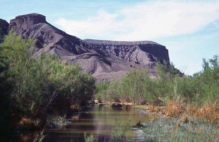
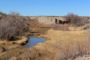
The Amargosa is a 183 mile long river that is almost all underground. So the only time it looks like a river is when it is flooded. There is a small, 26 mile section near Tecopa CA that is above ground, but the rest of it is all underground.
I am fascinated by this idea of an underground river that has so much impact on the people who live in the area. People talk about the river like everyone can see it. Because the river is close to the surface, people have good wells and enough water for the small amount of agriculture in the area. The water is very alkaline (hence the name amargosa meaning bitter) but it is relatively abundant. And because it is underground, it has not been stolen or preempted by the big cities nearby.
Tom and I hope to visit the above-ground part of the river before we leave this part of the world. So many things in Death Valley depend on their survival by staying hidden from the sun and heat. I just didn’t expect the Amargosa River to be one of them!