In my continuing quest to visit all 423 (as of 2021) National Park sites, Tom and I headed north to visit the Mississippi National River and Recreation Area in Minneapolis and St. Paul. This 72 mile stretch of the Mississippi River is surrounded by local, state, and the National Parks.
We started by heading toward the Mississippi National River Visitors Center in downtown St. Paul. Starting at the Visitors Center is always our first choice. We can see the movie, check out the exhibits, and talk to a ranger about hikes to take or places to see. Unfortunately, when I typed the Visitors Center into Google Maps, the center was listed as closed. I had done my research and knew that the Mississippi National River Visitors Center was located inside the Science Museum of Minnesota. So, when I found out the Visitors Center was closed, I thought “Fine, the Science Museum will still be open.”
Not so. Even though the home page of the museum says that they are open, The Science Museum of Minnesota is closed on Mondays and Tuesdays. We were trying to get there on a Tuesday. Rats!
Being the experienced National Park site visitor I am, I decided to do some research on other Visitors Centers in the area that might have info (and the stamp) for Mississippi National River. While I was trying to do this research, Tom was strongly urging me to hurry up as he needed directions on where to go. Tom was driving on our way to the park site. The St. Anthony’s Falls Visitors Center was closed at the end of September. This was the only other Visitors Center listed on their website.
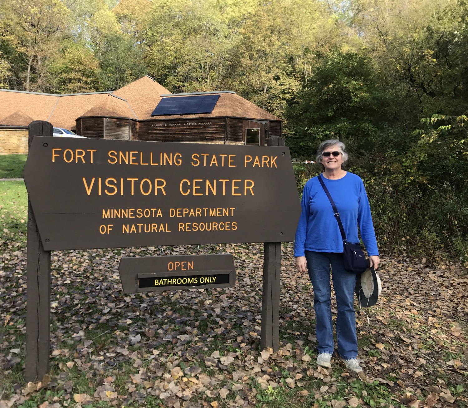
I looked on the partners part of the website and found several regional parks, none of which had Visitors Centers. Finally, I noticed Fort Snelling State Park. State Parks usually have Visitors Centers and the parks are rarely closed. I went to their website and saw that their Visitors Center was also closed on Mondays and Tuesdays. So I called the number listed on the website. Wonder of wonders, a real person – a ranger – answered the phone! And, miracle of miracles, the ranger station was open for people who wanted to purchase permits for Fort Snelling State Park. They even had the NPS stamp for Mississippi National River! Hallelujah!
I managed to find out where the Ranger station was located just in time to tell Tom to get off at the correct exit. Within minutes we were at the ranger station buying a day use pass and getting my stamp. All of that was much harder than it needed to be, but I was thankful to find someplace that was open on a Tuesday and had the stamp.
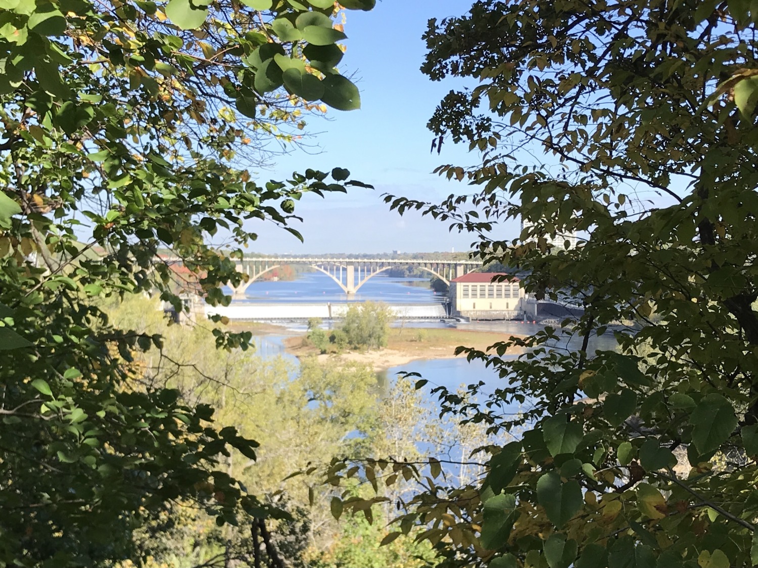
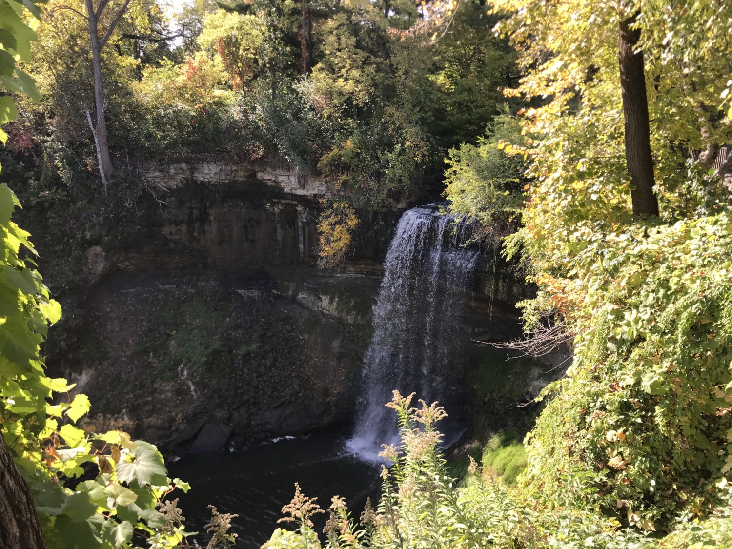
The ranger gave us a map of Fort Snelling State Park and talked about the different hiking trails. We had a choice of the Pike Island trail, which was a favorite among locals taking a morning walk. It was located entirely in the river valley and made a loop around the island. Our other choice was walking up to Minnehaha Falls. The ranger assured us it was about a mile and a half up the trail and put an X on our map where it would be. I have been to Minnehaha Falls (my father was stationed at Fort Snelling when he was in the army) several times but Tom had never been so we decided to walk there.
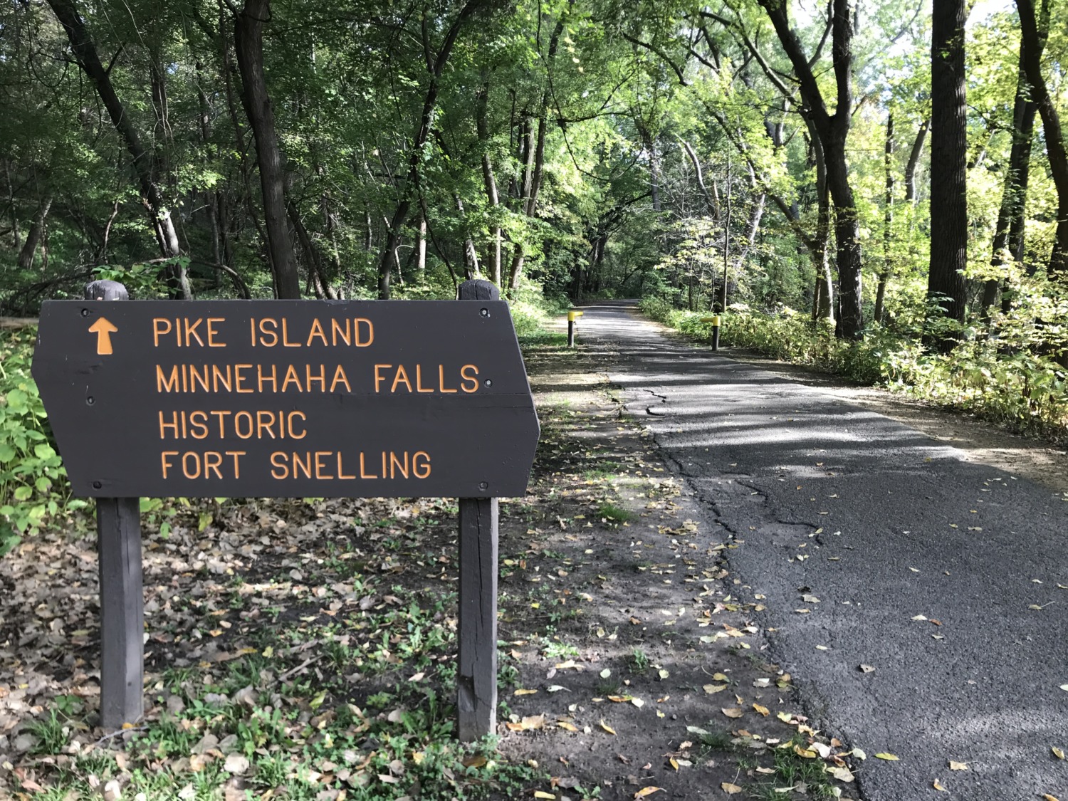
They need to let that ranger out of Fort Snelling State Park more often. She really had no idea where the falls were. We ended up walking 3.5 miles to get to the falls. It was a beautiful, warm day, and I did not take any water along because I didn’t expect the hike to be so far. So I was really dehydrated by the time we finally arrived at Minnehaha Regional Park. The park is gorgeous and the falls are really nice, but I had a hard time enjoying any of it until after I had something to drink. Fortunately there was a Dairy Queen across the street, the only store or restaurant in the whole area. We got something to drink and I got an ice cream cone and enjoyed resting for a bit in the shade. Then we could enjoy the falls.
The walk back to the car wasn’t as bad. We knew how far it was and had been refreshed by something to drink. Plus, it was downhill instead of uphill. But the round-trip was more challenging than it needed to be if the ranger had given us the right information to begin with.
Aside from this particular trip, Tom and I like this area of Minnesota a lot. Minneapolis and St. Paul are really nice cities and not hard to navigate. The downtown area around the Mississippi River is loaded with parks and green space and has plenty of parking. People from “The Cities” walk a lot and get outside as much as possible. There are lots of bike and cross-country ski trails and walking paths. I hope to go back sometime. Just not on a Monday or Tuesday.