
 Did you know that there is a plan to connect the Ohio River with Lake Erie by bike trail? It is called the Ohio to Erie Trail and it has been in the works about as long as there have been bike trails in Ohio. Of the 300 planned miles of the Ohio to Erie Trail, 240 miles are already completed. Tom and I have ridden many of the trails that make up the Ohio to Erie Trail and someday we hope to ride the entire completed trail. We have noticed lots of very nice new signs along the bike trails in Columbus designating them as part of the Ohio to Erie Trail.
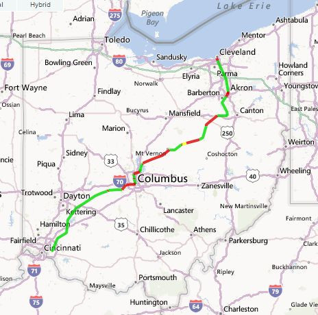
The Ohio to Erie Trail will run from Cincinnati to Cleveland along off-road trails that are built on abandoned railroad beds or along canal towpaths. Ed Honton dreamed of this trail back in 1991 when some of the first bike trails were being developed in Ohio. He dedicated his life to making his dream a reality and can be considered the founder of the Ohio to Erie Trail.
When complete, the Ohio to Erie Trail will connect four of Ohio’s metropolitan cities (Cleveland, Akron, Columbus, and Cincinnati), a dozen large towns and numerous small villages – all done on easily accessible, paved trails, that are completely separated from highways and automobiles. Along the way, the trail passes through farmland, nature preserves, and local parks which protect the green spaces in Ohio.
Right now, all the trails that are part of the Ohio to Erie Trail are developed and administered independently. They are best known by their individual names. The two trails at the northern and southern ends are the longest completed parts of the Ohio to Erie Trail. The Little Miami Scenic Trail that runs from Xenia to Cincinnati is 75 miles. The Ohio and Erie Canal Towpath Trail from Cleveland to Massillon (this trail continues south but not all of it is part of the Ohio to Erie Trail) is 85 miles.
Other trails that are completed parts of the Ohio to Erie Trail are Prairie Grass Trail, Roberts Pass, Camp Chase Trail, Scioto Trail, Olentangy Trail, Westerville Bike and Walk Route, Genoa Trail, Hoover Scenic Trail, Heart of Ohio Trail, Kokosing Gap Trail, Mohican Valley Trail, Holmes County Trail, and Sippo Valley Trail. I have done blog posts on the trails that are highlighted. I also blogged about the Ohio and Erie Towpath Trail. We have also ridden the Kokosing Gap Trail but we rode it before I started my blog, so I will have to ride it again before I can write about it!
The sixty miles of the Ohio to Erie Trail that have not been completed are, of course, the most difficult and expensive to build. The section through downtown Columbus will probably be one of the last sections to be finished. Even though it is only a few miles, it passes through one of the most congested and developed parts of the state. So far there is no accepted solution for getting an off-road bike path through this area.
Ohio is one of the best states for developed bike trails. When the Ohio to Erie Trail is completed, it will be a draw to bicyclists throughout the United States. Right now, the parts that are completed are wonderful trails to ride and enjoy. To find all the developed trails in Ohio at a wonderful interactive web site, click here.
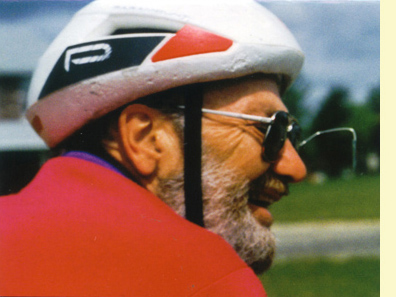
Tom and I love to ride bike trails wherever we find them. Riding our tandem is a great way to see the land around us up close and personal. Bike speed is the right speed for us!
One comment