I have always wanted to see Hadrian’s Wall and walk along it. The day after our disappointing trip to the Trossachs National Park I got my chance. Tom and I signed up for this shore excursion a while ago, knowing it would be our only chance to see Hadrian’s Wall on this trip. We just hoped the bus would stop long enough for us to get out and walk.
Our ship docked in Tynemouth, east of Newcastle Upon Tyne. Guess what river both cities are beside. I’ll wait. If you guessed the Tyne River, you are right. Tom and I climbed onboard our bus, hoping for the best. Our guide was good, although I don’t remember his name. He didn’t talk to much but knew a lot about Hadrian’s Wall. He started off the tour by telling us the two places we would be stopping (Hooray!) and what we would be doing at each place.
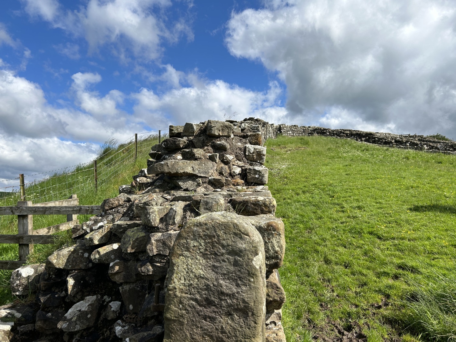
We started by driving along the wall and learning about it. Hadrian’s Wall was built by Roman soldiers in six years, beginning in 122. It was a defensive fortification of the Roman province of Britannia authorized by Emperor Hadrian. The wall originally stretched from Wallsend on the River Tyne in the east to Bowness-on-Solway in the west. It was a stone wall with large ditches in front and behind, stretching across the whole width of the island. Soldiers were garrisoned along the line of the wall in large forts, smaller milecastles, and intervening signal turrets. The gates in the milecastles served as places of trade between the north and south.
Hadrian’s Wall Path generally runs close along the wall. Almost all the standing masonry of the wall was removed in early modern times and used for local roads and farmhouses. None of the wall stands to its original height, but modern work has exposed much of the footings. Many of the excavated forts on or near the wall are open to the public, and various nearby museums present its history.
Hadrian’s Wall marked the boundary between Roman Britannia and unconquered Caledonia to the north. The wall lies entirely within England and has never formed the Anglo-Scottish border. The wall was designated a UNESCO World Heritage Site in 1987.
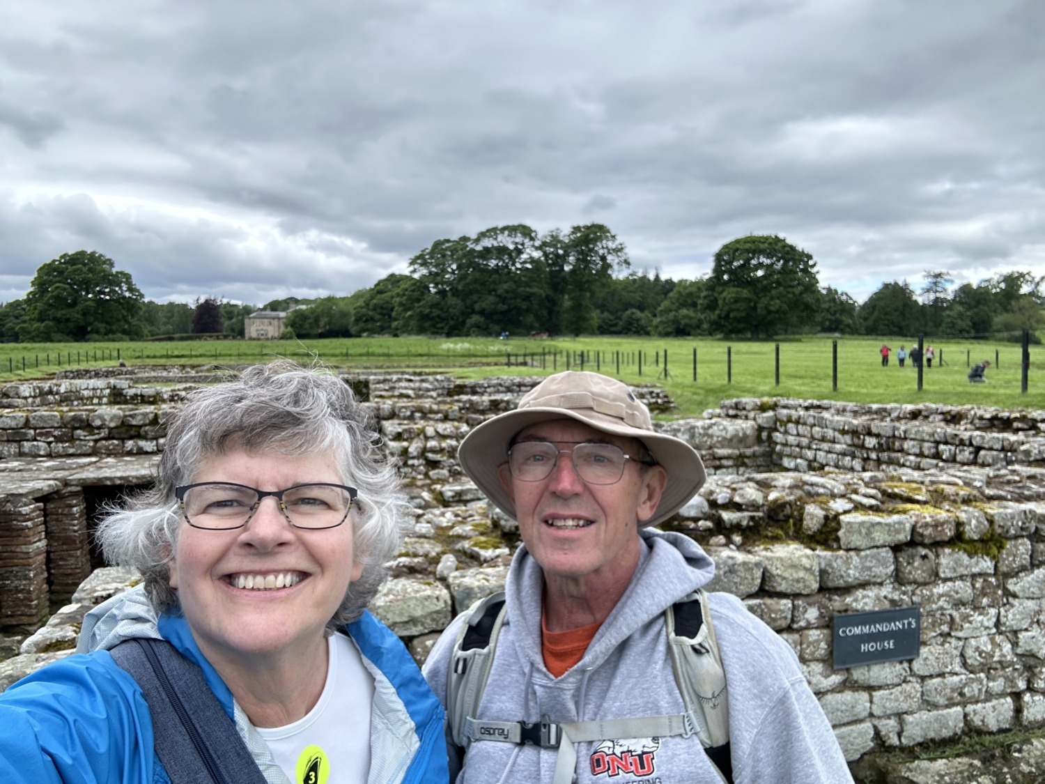
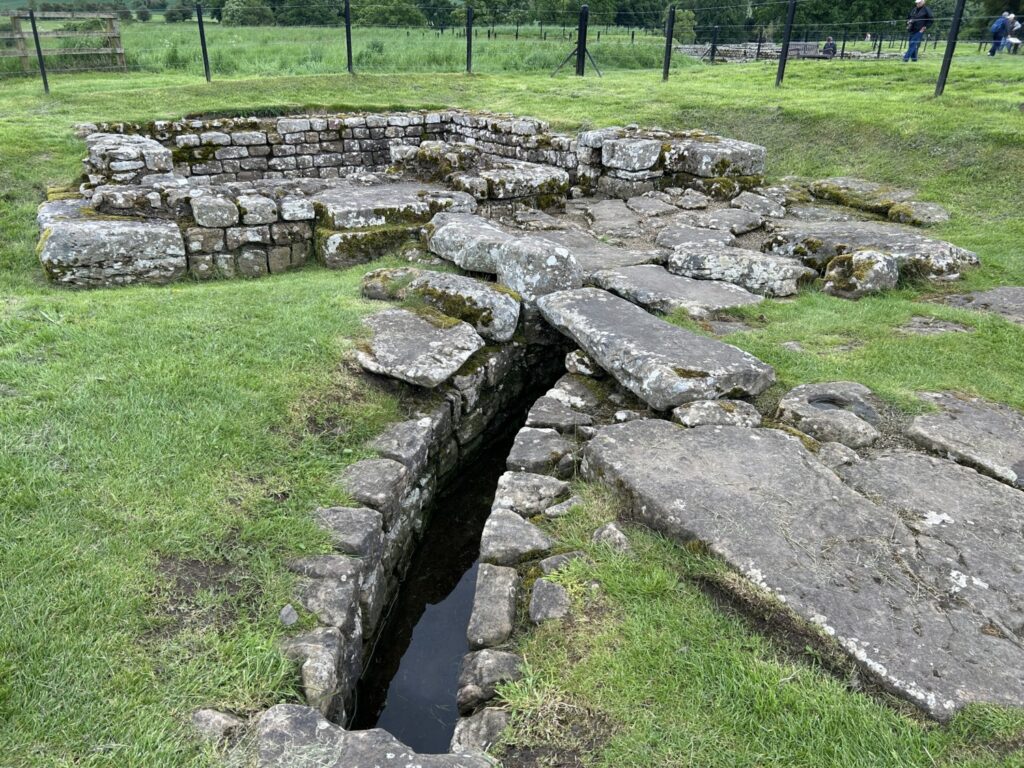
Our first stop was the milecastle at Cawfield. The Romans built a milecastle every mile, and 15 to 20 soldiers were stationed there. They built signal turrets every 1/3 mile so they had a line of sight along the wall. Forts were further apart and much bigger.
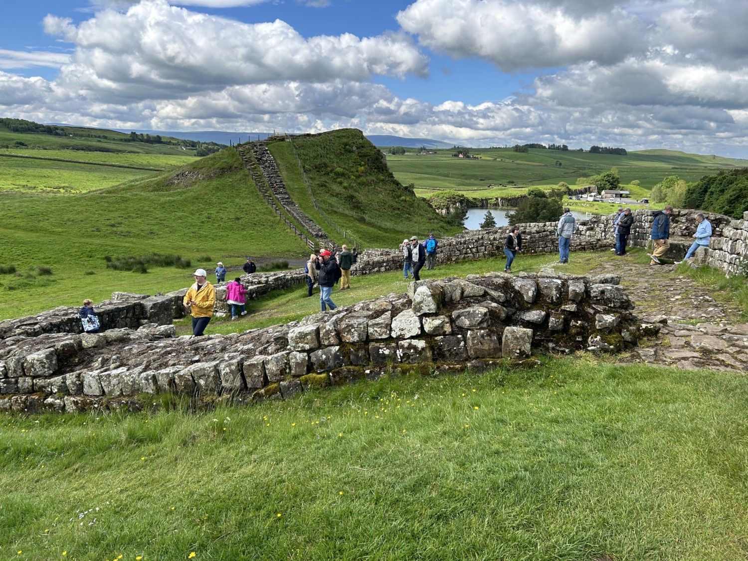
In order to get to the remains of the milecastle, we had to walk along a very wet path with some large puddles. Most of our group headed up to the side of the path to avoid one very large puddle. I had on my hiking boots, so I just walked on through the puddle. Because of this, I was one of the first people to reach the milecastle. Instead of staying and waiting for the rest of the group, I headed up the hill along Hadrian’s Wall.
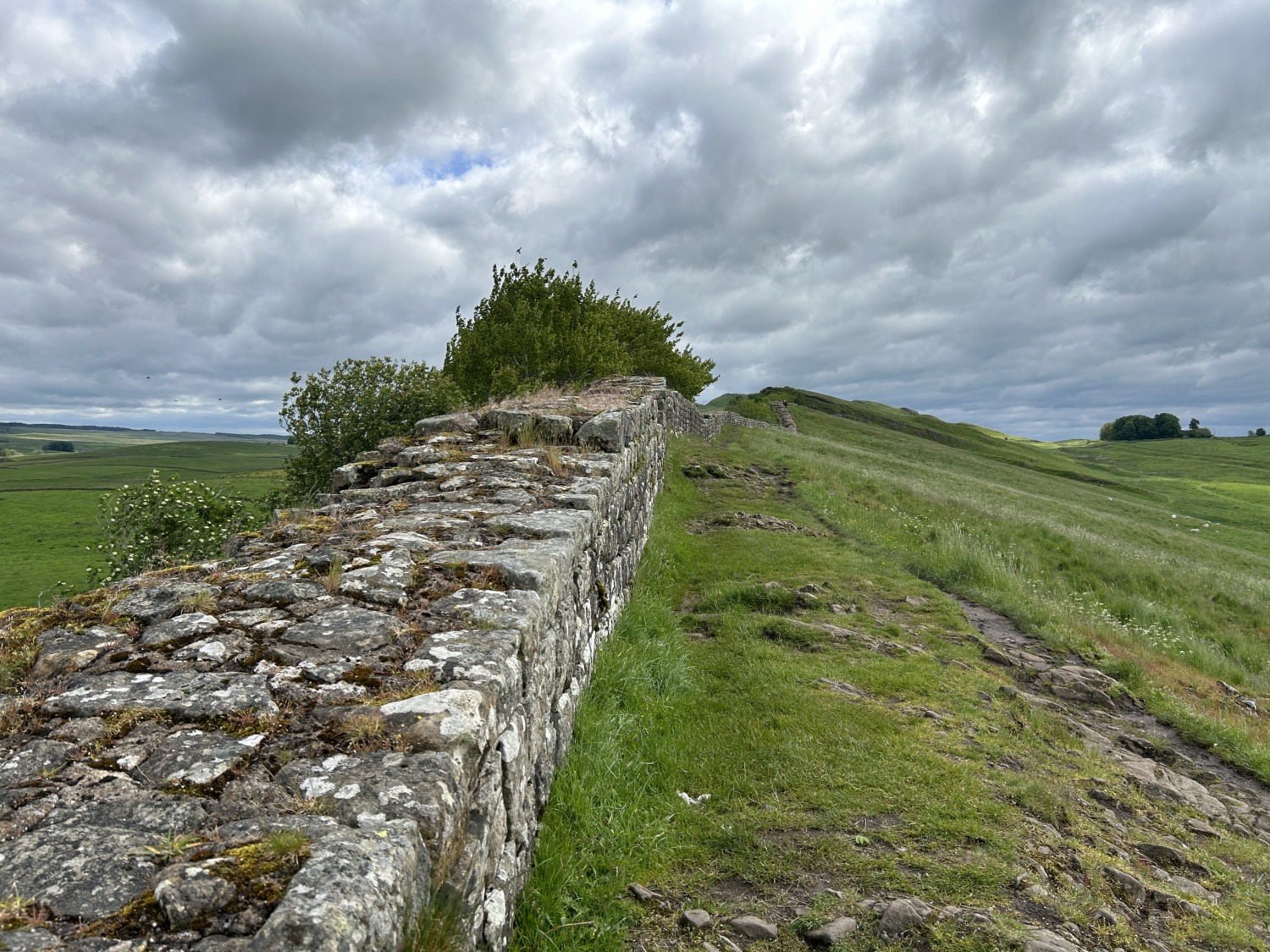
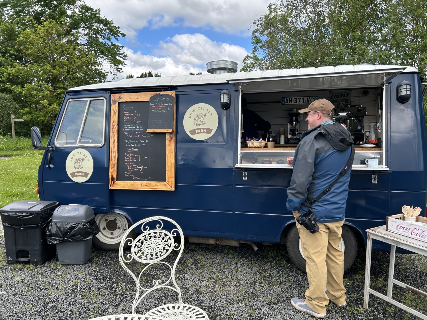
It was thrilling to walk along the wall, especially since I was by myself. I could see the rest of the group, but I had the horizon to myself. I took a ton of pictures, enjoyed communing with the cows and sheep, and imagined being a Roman soldier standing in that spot on the wall. So exciting! I could hardly contain my joy when I rejoined Tom and the rest of the group. We tromped back through the mud and puddles to the bus. There was a small farm food truck selling cookies in the parking lot, so I bought several. Important to support a local business.
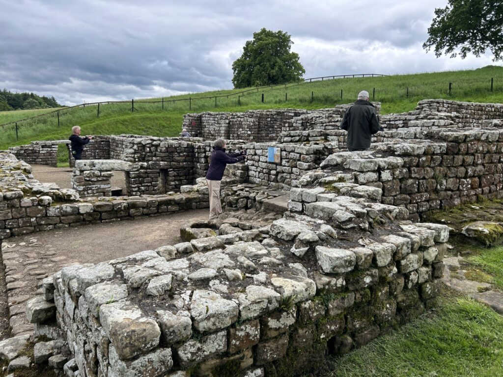
After Cawfield, our bus continued on to Chesters Roman Fort and Museum. The Fort is the most complete Roman cavalry fort in Britain. The foundations of the various buildings give a glimpse into the life of a Roman soldier at the forts. You can see the foundations and imagine the commanding officer’s house, the barracks, the storerooms, and the baths.
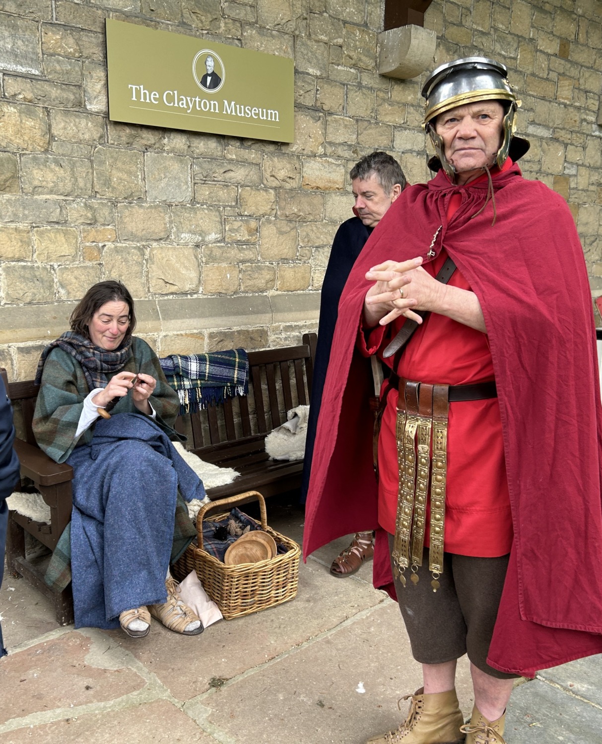
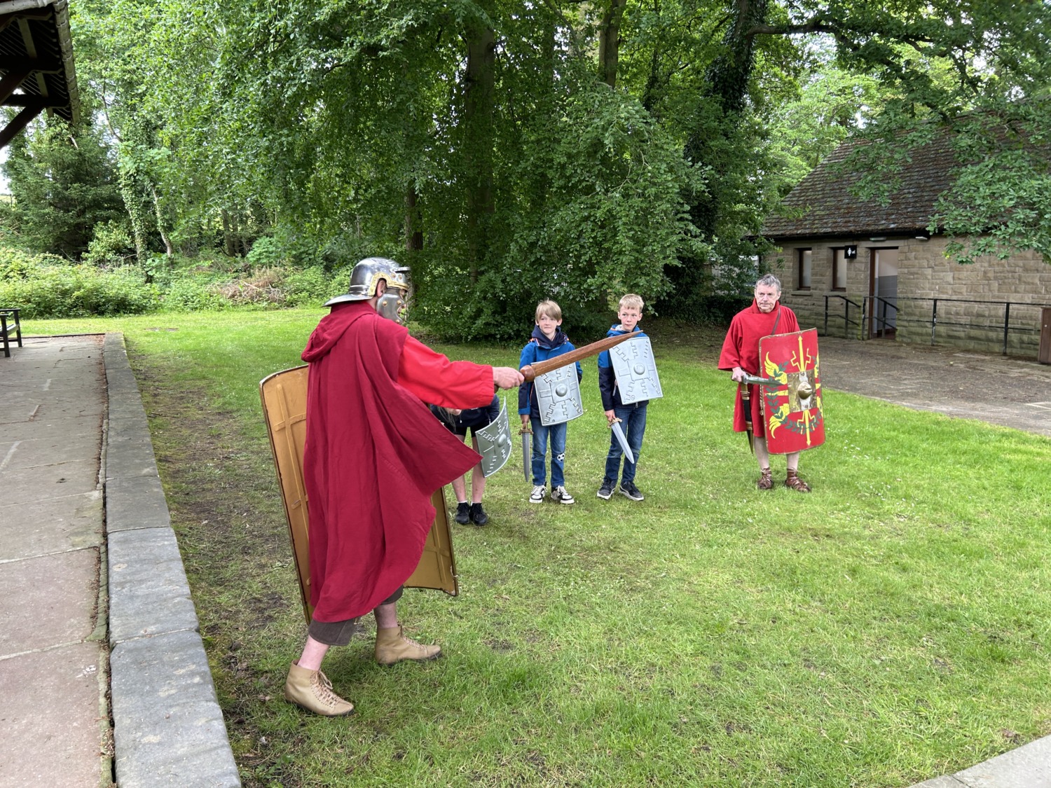
Tom and I did not do a good job of sticking with our tour guide. We kept him and the group in sight, but got distracted by Roman living history interpreters. Romans! Even older than Vikings! There were two Roman soldiers and a soldier’s wife. She was freezing, but trying to use a drop spindle with her frozen fingers. We talked about historic knitting for a while and the clothing she had on. Tom talked to one of the soldiers about his weapons and what the area would have looked like in Roman times.
We caught up with our group and looked at the various building foundations. Then we headed into the museum for a quick glimpse. We were sorry we didn’t have more time because it was packed with Roman cornerstones (this company built this section of wall), milestones, and tombstones. There were also altars to the various gods worshipped by the Romans at the time. Very interesting.
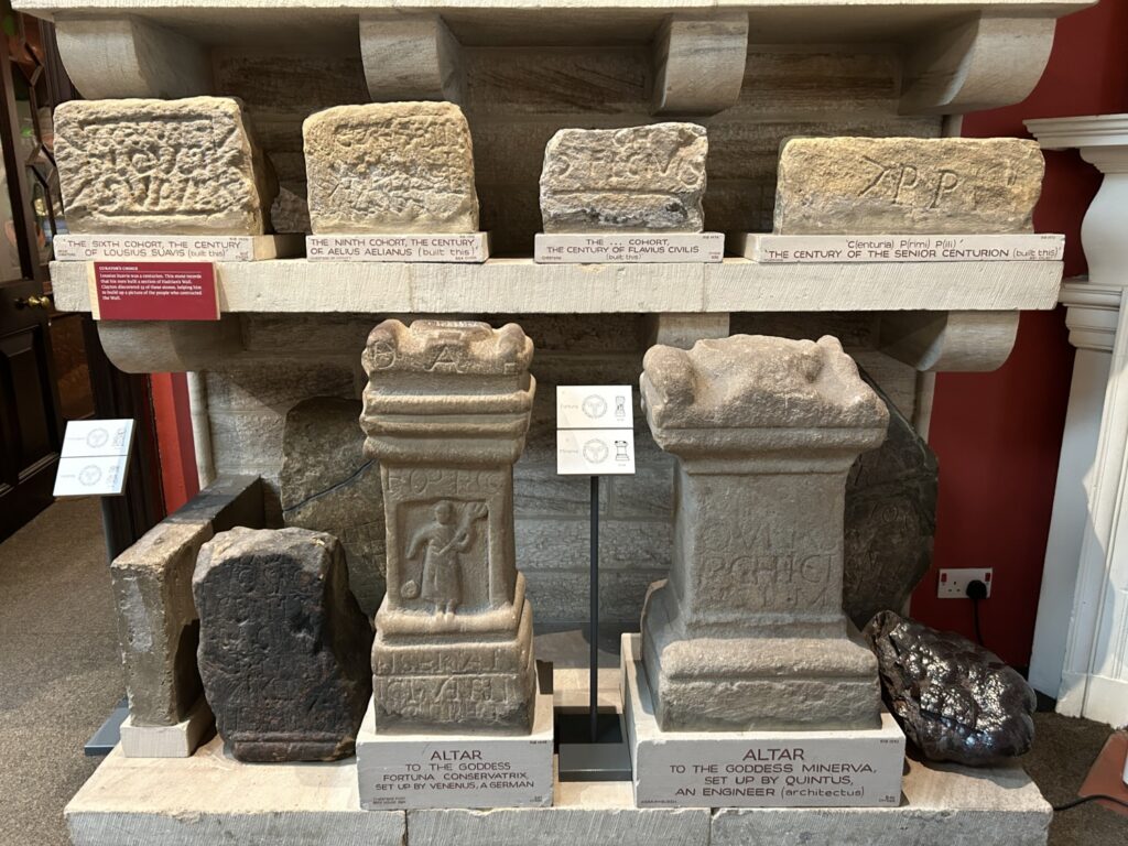
Much of the current preservation of Hadrian’s Wall is thanks to John Clayton. John worked to buy land on which the wall stood. Eventually he controlled Chesters, Cawfields, Housesteads, and Vindolanda. He excavated the forts and milecastles and collected artifacts for a museum. He employed workers to restore sections of the wall. The parts of the wall preserved today are largely thanks to John Clayton and the museum is dedicated to him.
All too soon it was time for us to leave. We headed back to the ship along another portion of Hadrian’s Wall. Getting to see the wall was one of the highlights of the trip so far for me. I was able to cross an item off my bucket list.