
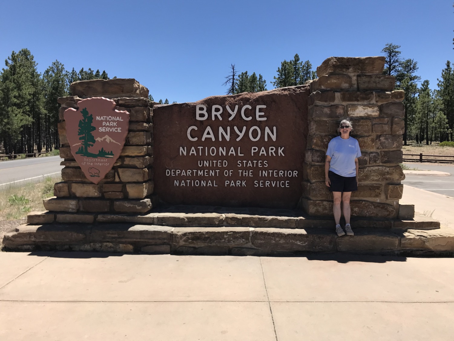
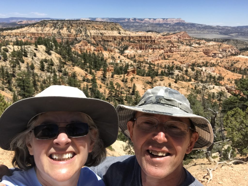
 After hiking around Red Canyon, Tom and I decided to drive up to Bryce Canyon National Park. As I mentioned last week, we have visited Bryce Canyon National Park several times. It is one of our favorite parks. Bryce Canyon is more accessible than the Grand Canyon and less crowded than Zion. The scenery (and the elevation) takes your breath away.
We intended our visit to Bryce as a scouting mission. What do we still want to see and do there? Can we do it in day trips or do we need an overnight stay? Is there a good place to stay?
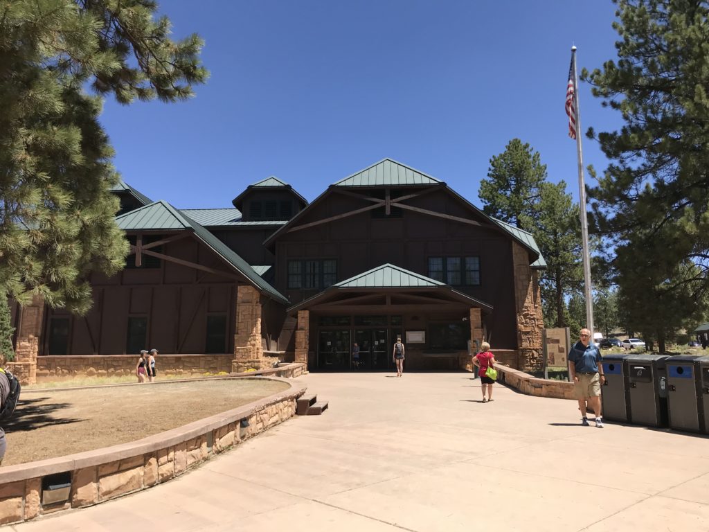
Our scouting mission was successful, but – of course – we also had to hike a little. We started at the Visitors Center and enjoyed the movie which showed Bryce Canyon in all the seasons. Tom wondered if we could volunteer at Bryce in the winter – would it be too cold? Finding out that they have nearly 250 nights below freezing and get about 11 feet of snow each winter answered that question! We checked out the museum and the bookstore and I stamped my passport book.
The museum is small but interesting. It describes the entire Grand Staircase and had a wonderful topological map. The map had all the national parks in southern Utah and northern Arizona marked on it, including Pipe Spring! When Tom was recently looking for a new demo talk, I remembered the great map and suggested he build a topological model like it.
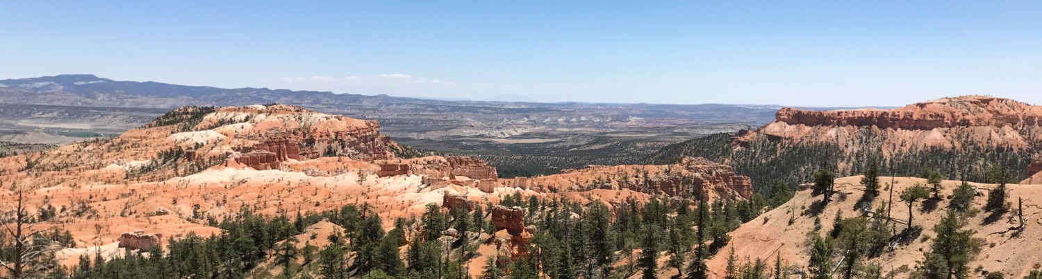
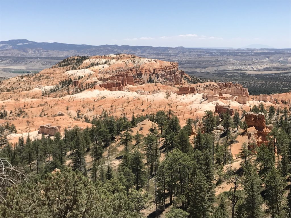
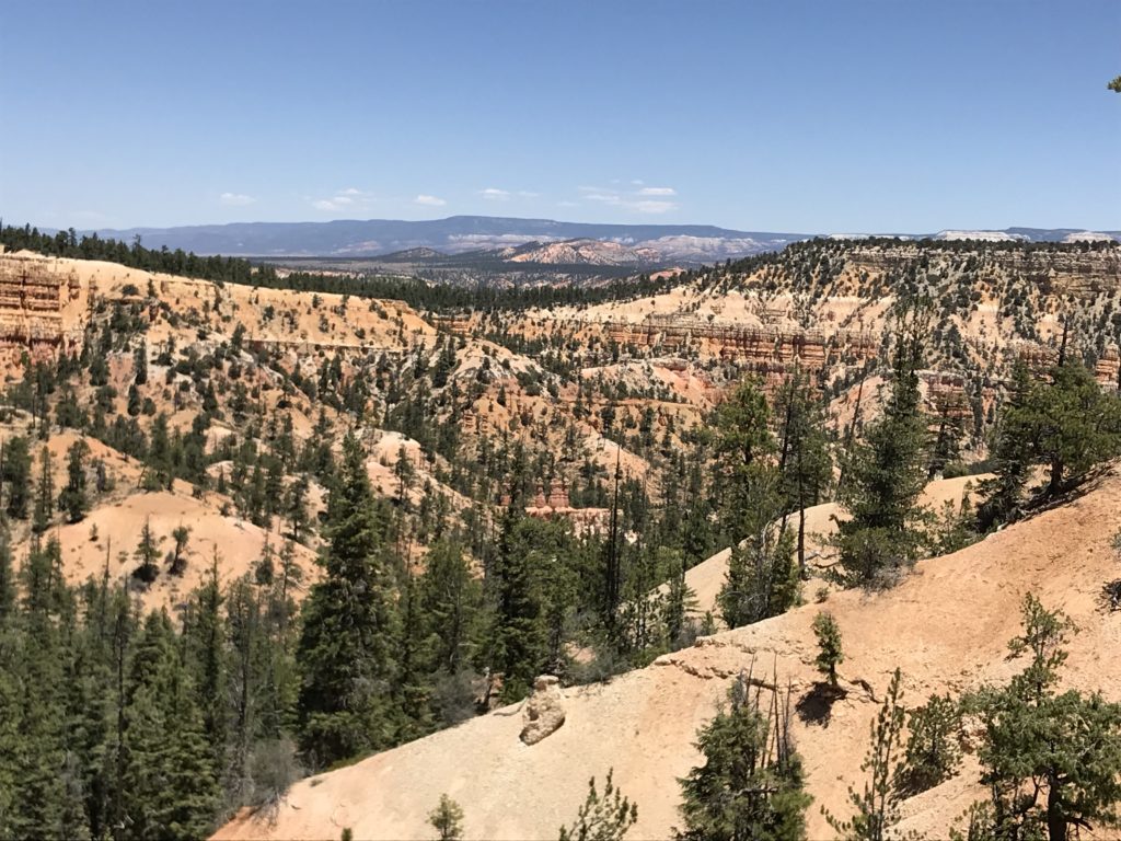
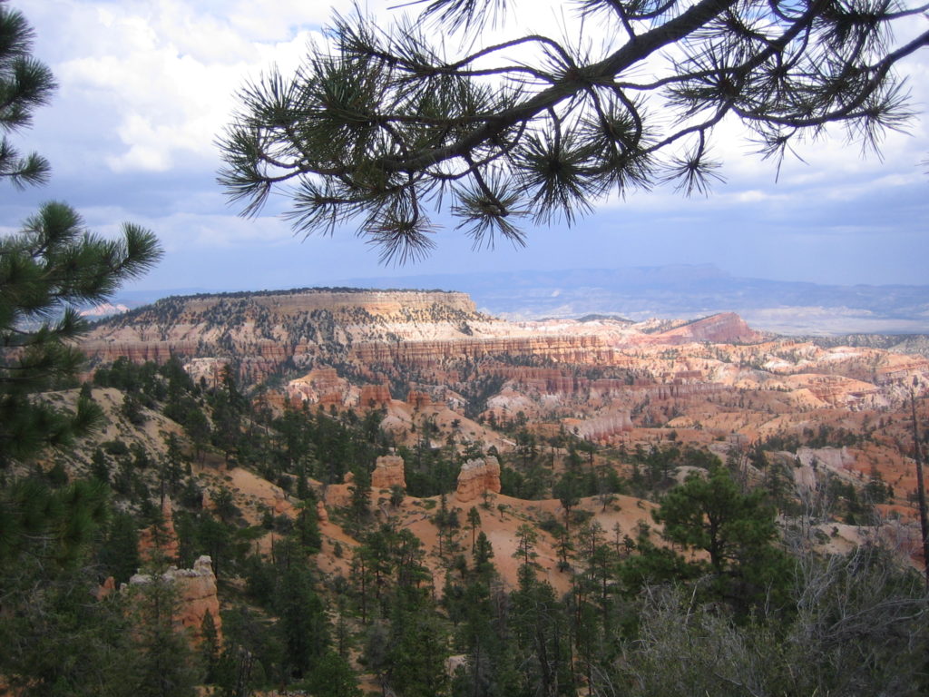
Bryce Canyon National Park is not a single canyon, but a series of natural amphitheaters or bowls, carved into the edge of a high plateau. The most famous of these is the Bryce Amphitheater, filled with irregularly eroded spires of rocks called hoodoos. There are four main viewpoints, all found within the first few miles of the park: Bryce Point, Inspiration Point, Sunset Point, and Sunrise Point. Between April and October a shuttle service is operated in this area of the park to reduce congestion. We saw lots of people taking advantage of the shuttle service to get from point to point.
Hoodoos erode out of the cliffs where rows of narrow walls form. these thin walls of rock are called fins. Frost-wedging enlarges cracks in the fins, creating holes or windows. As windows grow, their tops collapse, leaving a column. Rain further dissolves and sculpts these pillars into bulbous spires. Over time, new hoodoos are constantly emerging while others are reduced to lumps of clay.
The word “hoodoo” comes from the southern Paiute word for being scared. The southern Paiute thought the hoodoos were “Legend People” turned into rock for their bad deeds. As such, you must be careful and quiet walking through them because you don’t want to wake them. The quiet part is easy because every footstep brings a new, awesome wonder.
Most visitors to Bryce Canyon hike parts of the Rim Trail and enjoy the overlooks. On a previous visit, Tom and I hiked The Queens Garden and Navajo loop which takes you below the rim into the hoodoos. We also walked part of the Fairyland Trail. Going below the rim gets you away from the crowds. The canyon is accessible to most people because it is relatively shallow – at least compared to the Grand Canyon. The rim, however, is at 8,000 feet elevation, so you will be huffing and puffing as you come up.
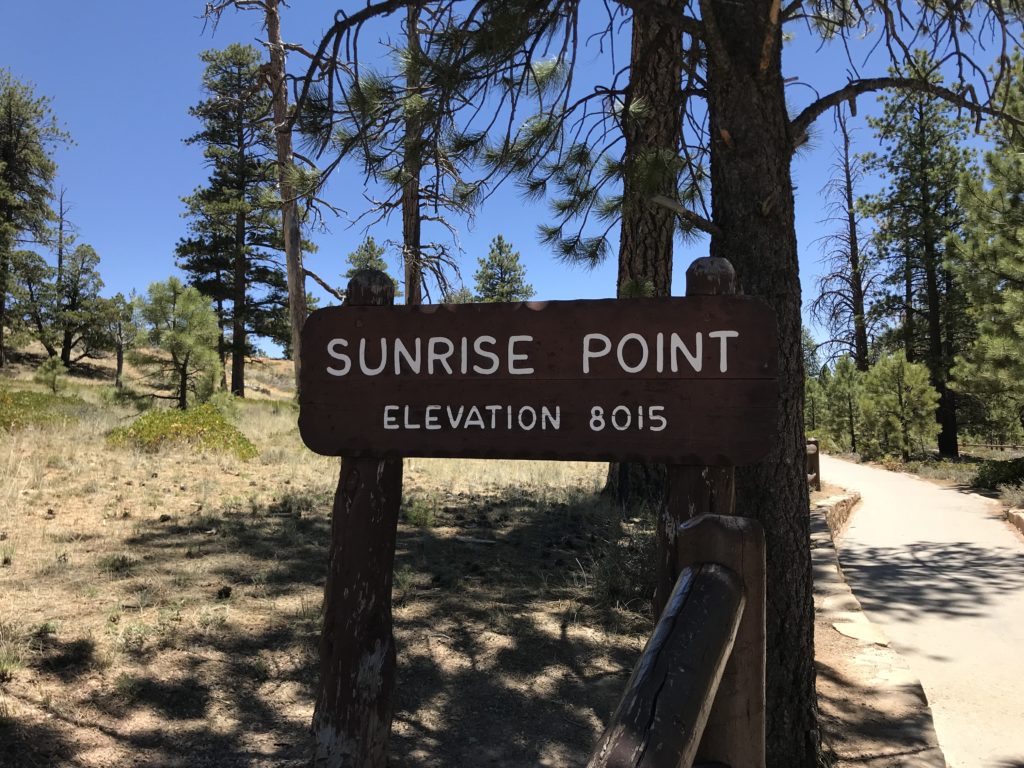
Because this visit was just a scouting mission, we only walked a portion of the Rim Trail from the Visitors Center to Sunrise Point. We passed the North Campground and the General Store. Then we headed back to the truck to continue the day’s explorations.
We will definitely be back to Bryce Canyon National Park in the next couple of months – maybe more than once. There are several hikes we want to take, including a couple of longer all-day hikes. You will be seeing more pictures from beautiful Bryce in the future.