
Tom and I have spent the last week hiking central Massachusetts. Eastern Massachusetts has Boston and the ocean, which is where most people who visit the state want to go. Western Massachusetts begins the Berkshires and flows into the hills of eastern New York so it is a very nice area to visit. Central Massachusetts has bogs, small rolling hills, lots of people in small cities and towns, and conservancy land for hiking.
All the hiking available in central Massachusetts has been a pleasant surprise. When you look at the map, you don’t see any large state parks or other “wild” places, but every town in this area, no matter how small, has conservancy land with trails to follow. Some of this land is former estates that have been left to the town or state. Some of the land was used for public pasture or for hunting. The conservancy land reminds me of the Akron Metro Parks, although most of them are not as well used as the Akron Metro Parks.
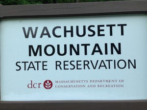
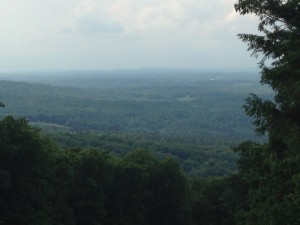
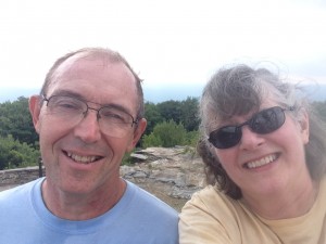
We have hiked trails in several towns. Last Sunday we hiked up Mount Wachusett in Wachusett Mountain State Reservation. Mount Wachusett is the tallest thing in central Massachusetts so we anticipated that the 1,000 feet of elevation gain would lead to great views. Unfortunately it was very hazy (it rained shortly after we finished our hike) and we couldn’t see much from the top. The trail was extremely rocky, with several scrambles on the way up, so we walked on the road on the way back down. It felt a little like cheating, but I had a bruised foot and it felt good to walk on level asphalt.
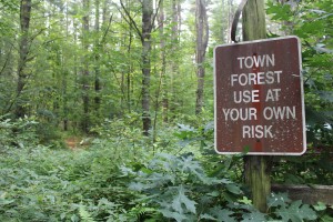
We hiked the Groton Town Forest in West Groton on Tuesday. This was a really pretty trail but it turned out to be infested with hoards (not just swarms) of mosquitoes. We saw a sign at the parking area that said “Town Forest: Use at own risk” which we didn’t understand at first. But then we realized it was referring to the mosquitoes! We had used lots of Deep Woods Off, but after several miles of hiking in 88 degrees with high humidity, we sweated it all off. At least, that is the only explanation I can think of why we both had mosquito covered shirts and appendages. Which might explain why we missed the turn-off for our trail and ended up about a mile from where we were supposed to be. We were hiking very fast (Bill Ruh told us if we hiked more than 4 mph we would create enough of a breeze that the mosquitoes couldn’t bite us – but I think he might be mistaken) and if we stopped, the mosquitoes covered us instantly, so we couldn’t stand still to read the map. We didn’t realize we had missed our turn until we got to the edge of the forest. So not our most pleasant hike and I had too many bites to count when we got done. Since then we have tried to avoid trails next to wetlands.
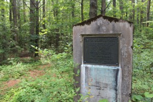
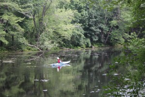
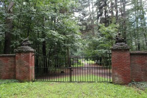
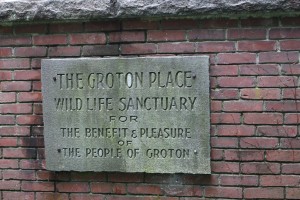
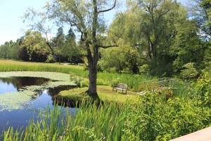
Saturday we walked around the Groton Place Wildlife Sanctuary which is a popular area for walking dogs. It is pretty flat and runs along the Nashua River but the bugs were not as bad as we feared. We also walked up Gibbet Hill in Groton. Both of these conservancy areas were part of estates that were left to the towns after the owners passed away. The Groton Place Wildlife Sanctuary was part of the Dumaine estate and Gibbet Hill was part of the Bancroft estate. The Bancroft estate had the remains of a castle on it, built in 1906 and burned down in 1932.
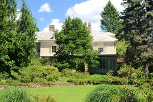
Sunday we headed to Leominster to walk the Doyle Conservancy Park, part of the Harry Pierce estate. The Pierce estate house is still on the property: 29 rooms with a stable and large horse paddocks. There was a main path that was covered with gravel and easy to follow, and then there were paths cut through the woods and through some meadows. We tried to follow these paths and ended up going around one section twice looking for the path through the meadow. We took the road bordering the park instead. There was a lovely pond, tiny frogs, and lots of dragonflies.
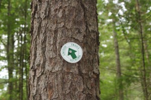
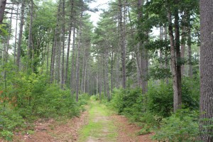
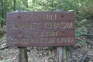
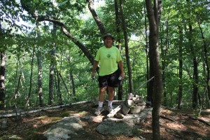
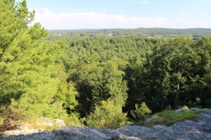
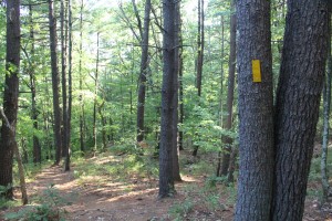
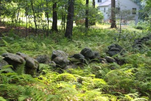
Monday we hiked Oak Hill Tophet Chasm Conservation Land in Littleton. We thought the Tophet Chasm might be a “grand canyon.” It was a good canyon – fairly deep and steep – but more of a forested valley than a canyon. There was a swamp at the bottom of the chasm, so – remembering our experience at Groton Town Forest – we decided to stay on the rim. We were still pestered by gnats and mosquitoes, but not to the extent of the forest. Most of the walk was through old growth forest. We climbed Summit Rock, the highest place in Littleton, with no view except trees, and then went around to Lookout Rock, which had a very nice view of the interstate. We also got to walk along two old stagecoach roads, bordered on one side by a rock wall built around 1830. The trails at Oak Hill Tophet Chasm were the best marked of any trails we have hiked. They had plastic blazes that were easy to see and follow.
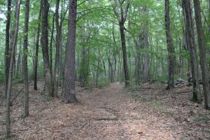
These are just a few of the trails on conservancy land in central Massachusetts. Tom and I figured that we could hike a different conservancy area every day for several months and never have to drive more than 20 miles. These trails and the conservancy land are a wonderful green resource in a densely populated area.