On our adventure day last week, Tom and I took off with two other volunteers, Val and Johnny, and drove up the Gunflint Trail. The Gunflint Trail is one of several scenic drives in the area. It follows MN 12 from Grand Marais to the Boundary Waters Wilderness Area, 55 miles each direction.
Saturday was rainy and cool – maybe not the best day for a scenic drive – but we were on a quest. We wanted to see moose and we were told that the best place to see them was along the Gunflint Trail. The moose stay away from the coastal area, preferring the quiet marshes and shallow lakes in the backcountry. The Gunflint Trail follows a high place between lakes and seemed to be perfect moose spotting territory.
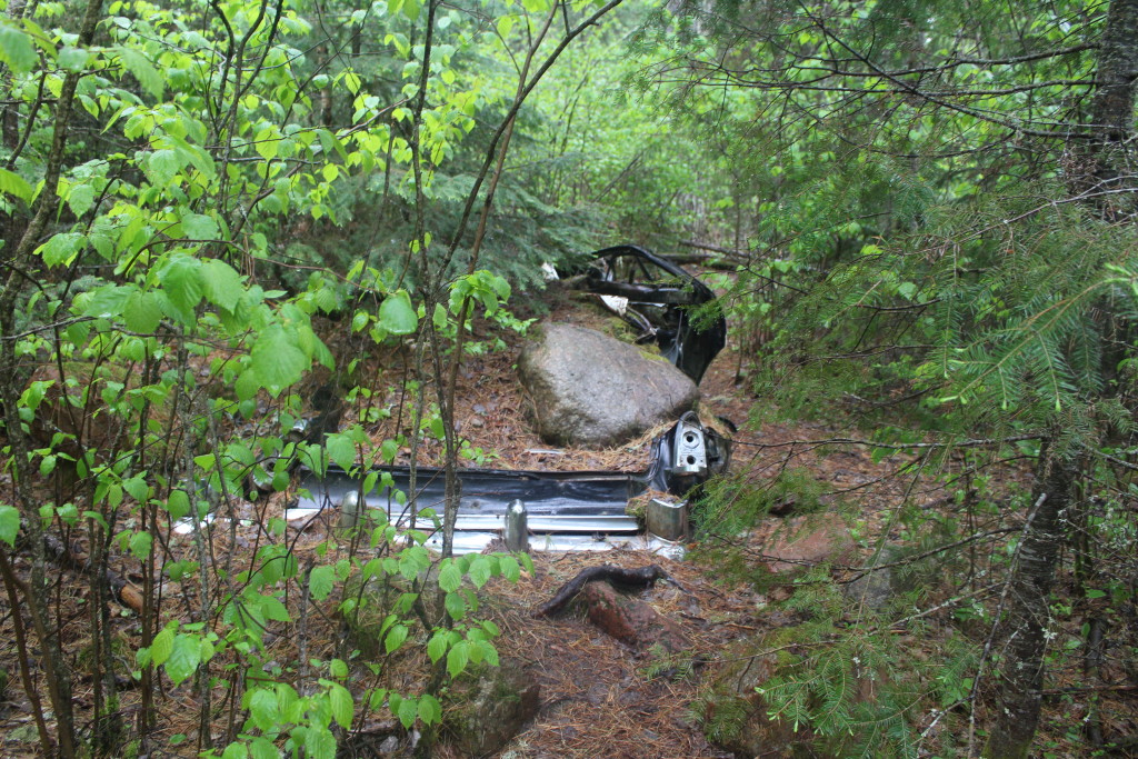
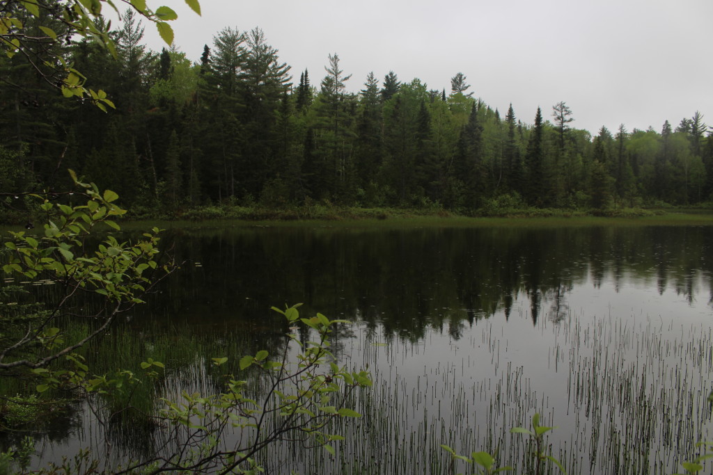
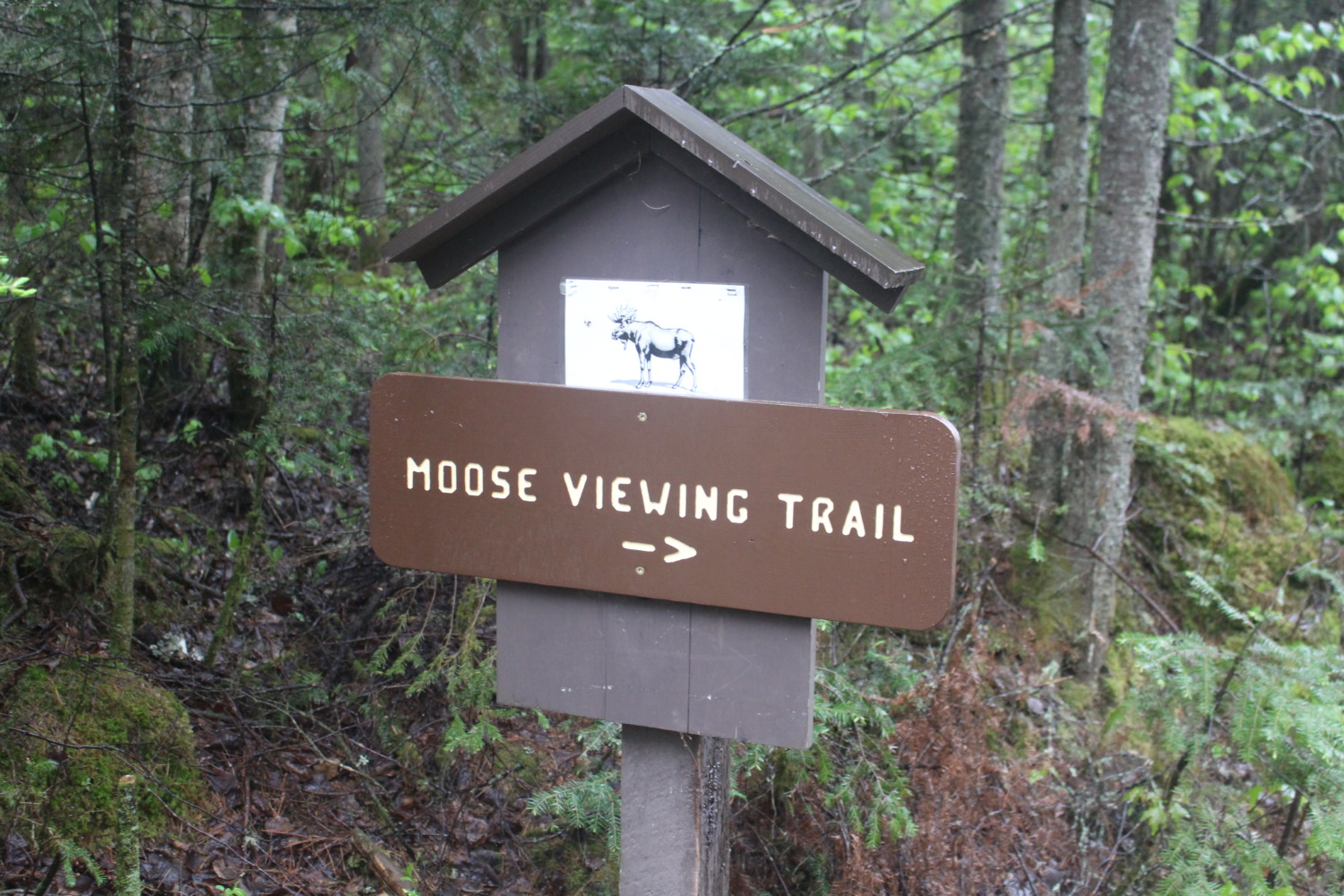 We took several hikes along the trail. The first was the Moose Viewing Trail in Superior National Forest. Although the trail led to a lovely lake, we did not see any moose. There was an old abandoned car along the road. I was coming along last of our group and was the only one who spotted the car – it was so well camouflaged. After the group looked at it, we couldn’t figure out why it was where it was – and what it was doing with a huge rock on top of it.
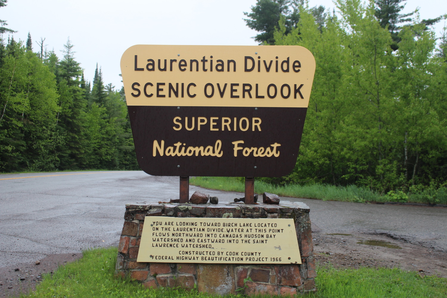 Our second hike was at the Laurentian Divide, called “The Height of Land” by the voyageurs. At this spot, everyone who was in their first year of wintering in the back country had a baptism in the waters. The experienced winterers would put a spruce branch in the water and sprinkle it on the head of the new winterer. The new winterer promised “never to kiss a voyageur’s wife without permission” and to do this ceremony for anyone else in their first year of wintering in the back country. We reenacted the moment by shaking a spruce branch over our heads, sending down a shower of rain.
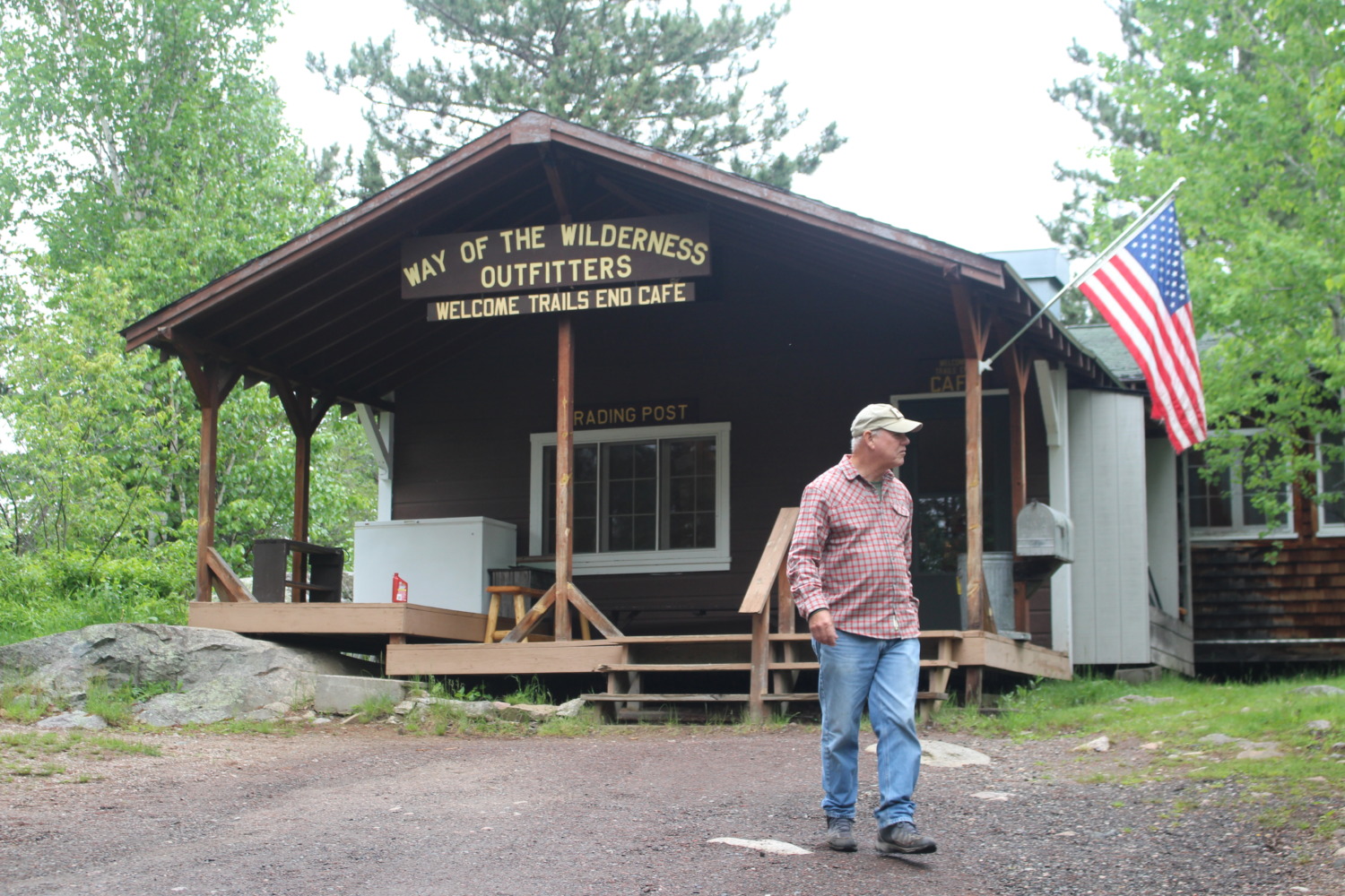 The next trail was at The End of Trail. MN 12 dead ends into a lake with a small “trading post,” restaurant, and campground. The trading post had a handful of items for sale and the restaurant was none too clean. We needed a restroom break, but their restroom was out of order so we used the pit facilities next to the campground parking lot.
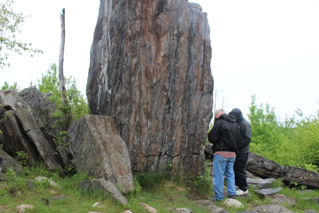
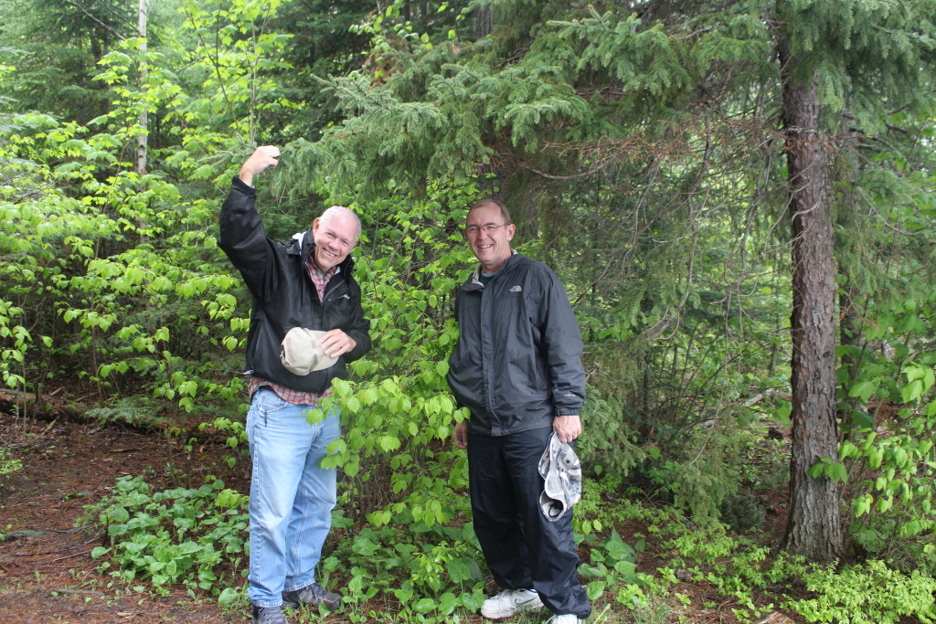
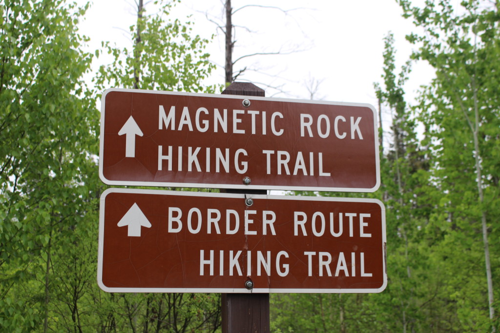
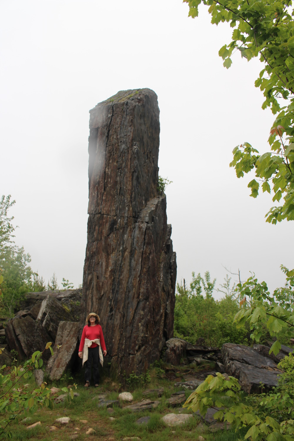 Our final hike was the Magnetic Rock Trail. The hiking book I read, “Hiking the North Shore” by Andrew Slade, says this about the hike: “A journey through terrain both blown down and burned away culminates in a visit to a lonely landmark, mysterious Magnetic Rock.” Magnetic Rock is a 25 foot high column of magnetite. When we reached the rock, Johnny got out his phone compass and he and Tom took some readings that showed the influence of the rock on north. Of course we couldn’t stay too long because of the mosquitoes. It was a pretty hike despite the drizzly rain which picked up shortly before we got back to the truck.
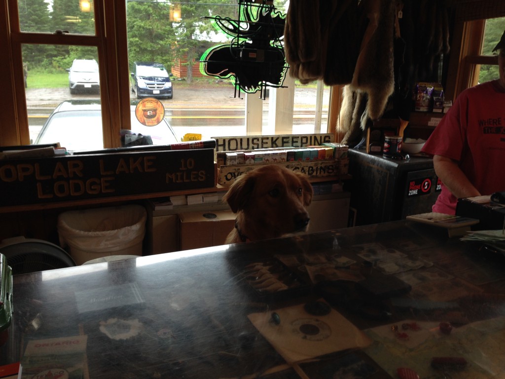
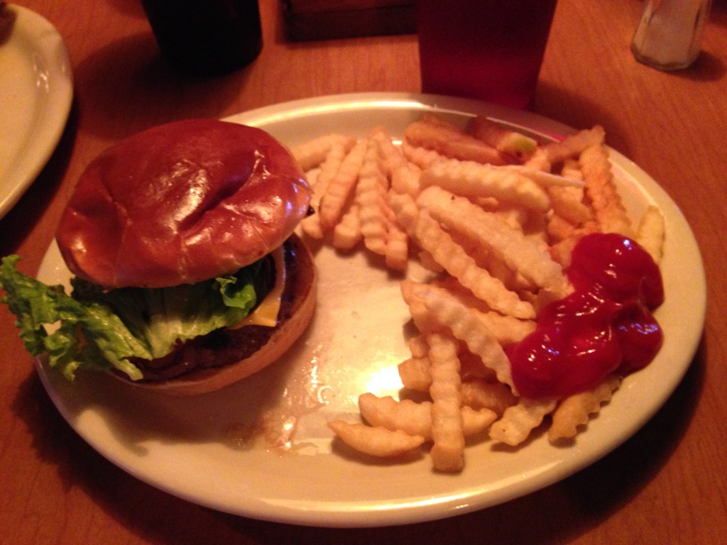
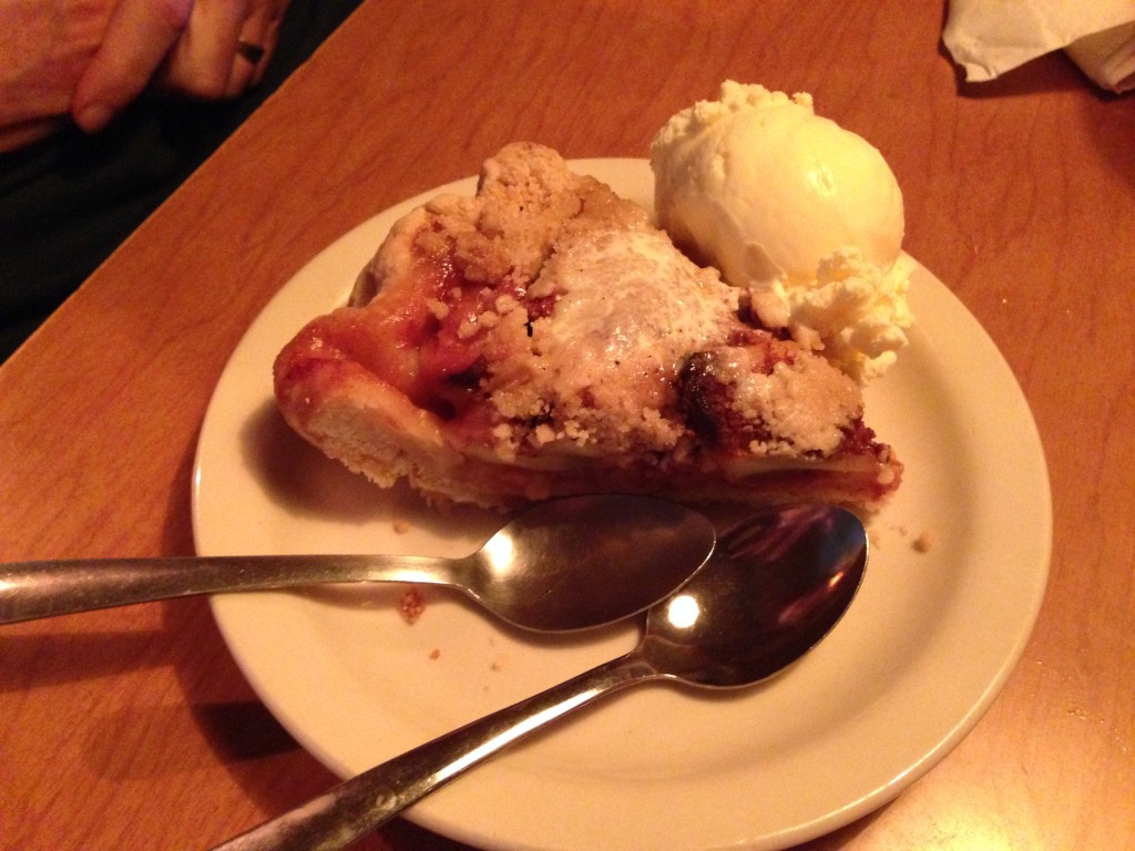
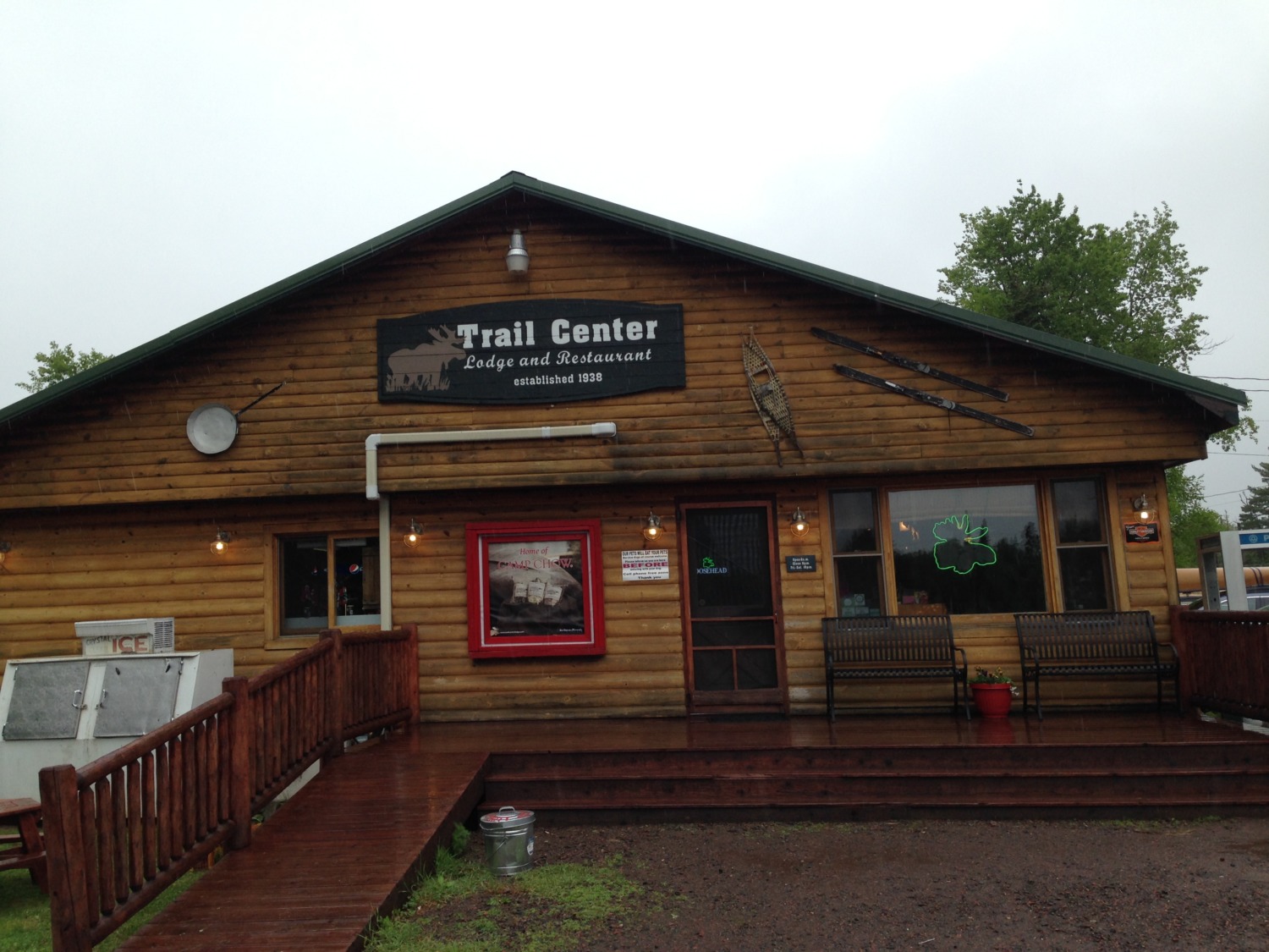 We finished our time on the Gunflint Trail with a late lunch / early supper at Trail Center Lodge and Restaurant. It was located – where else? – about halfway along the Trail. One of the rangers recommended it and it lived up to the billing. The inside was a funky mix of historic and north country kitsch. We were greeted at the door by a dog that put its front paws on the counter and looked at us just like it was asking if it could help us! There was a camp store with lots of good stuff including “Fruit of the Loon” jams and jellies. We all had burgers which were delicious – and we needed the red meat after the bloodletting by the mosquitoes. We also tried some of their homemade pie. Tom and I shared a piece of apple and Val and Johnny had a piece of mixed berry.
Did we see any moose? Nope. We asked several folks and they said sunset was the best time to see them. Unfortunately sunset up here is close to 9 p.m. and we didn’t want to hang around that long. So we may have to make another trip later in the summer.
The Gunflint Trail was an adventurous way to spend a rainy Saturday. We enjoyed exploring the area and we especially enjoyed the food at Trail Center.