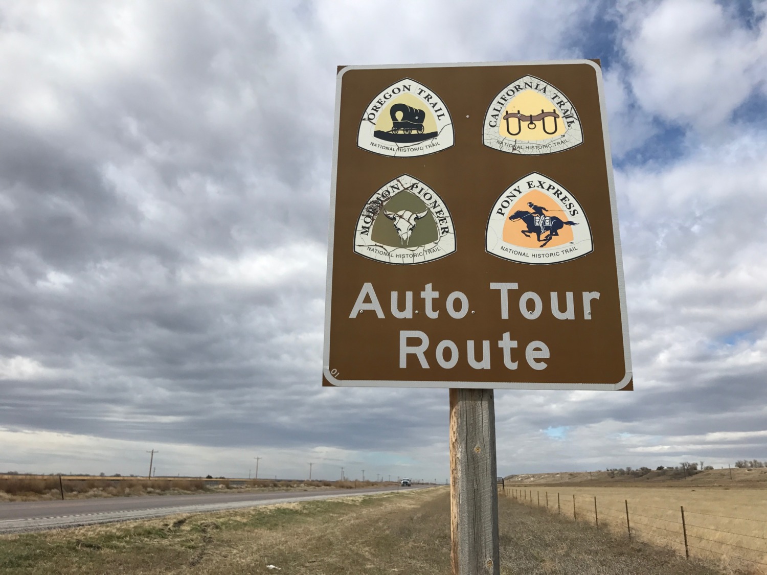
 When last we left our heroes, they were pulling their covered wagon east as they headed for Ohio and a return to their old life . . . . The opposite direction the pioneers went as they rode in covered wagons west searching for a new life. As Tom and I explored Idaho, Wyoming, and Nebraska and traveled along the I-80 corridor, we kept coming on signs for the various trails the pioneers took as they headed west. We expected to be on the Oregon Trail – and I will write about that soon – but we were surprised at how often we saw signs for the California National Historic Trail.
As I stated before, the National Park Service administers 30 National Trails in partnership with local organizations. I wrote about the Lewis and Clark Trail in a post you can find here. The National Park Service produces excellent Auto Route Interpretive Guides that you can download for the states the trails go through. We picked up several of the printed books. They made our drive more interesting as we noticed some spots we would have zoomed by without the guides. I highly recommend downloading these guides if you are planning a cross-country drive.
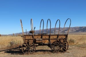
The California National Historic Trail crosses ten states and 2,000 miles from Missouri to California. Between 1841 and 1869 more than 250,000 people set out for the “El Dorado of the West.” Free land, gold, and adventure called to the pioneering spirit. Pamphlets promoted the ideal climate, prospects for wealth, and better health to those who made the journey to California. In addition, the idea of “manifest destiny” had gripped the country, making it seem patriotic to move west and fill the vast land with Americans.
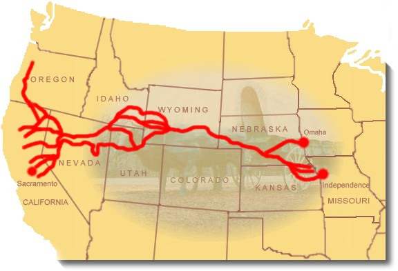 The California National Historic Trail was really composed of many different trails heading to California via various routes. As the pioneers encountered mountain ranges and natural features like the Great Salt Lake, they tried to find easier routes. So the trail resembles a broomstick with the handle along the Platte River in Nebraska and the broom spreading out in Wyoming, Utah, Nevada and into California.
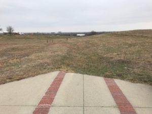
The California Trail was never easy. It took months of jolting, strenuous travel to make the journey. Many of the emigrants died along the trail. Some of the journeys were so disastrous that we remember them today: The Donner party is one that comes to mind. Salt Lake City was a popular way station. By 1860 so many people traveled the California National Historic Trail that it became a road and much of I-80 follows it today.
When the western migration started, the Native Americans were largely friendly and helpful. They would trade for food and guided some of the early wagon trains. As the number of easterners increased, however, the Natives became increasingly hostile. The emigrants destroyed Indian food sources and had little respect for the Native land claims.
In 1869 the Union Pacific and Central Pacific connected their rail tracks at Utah’s Promontory Summit. This joining of tracks created an easier, faster way to travel to California and signaled the demise of the wagon trails. But the experience of the emigrants lives on in the ruts in the ground and the journals they left behind. Seeing the historic markers and imagining what the travelers experienced kept us engaged as we crossed the vast distances of the western states.