
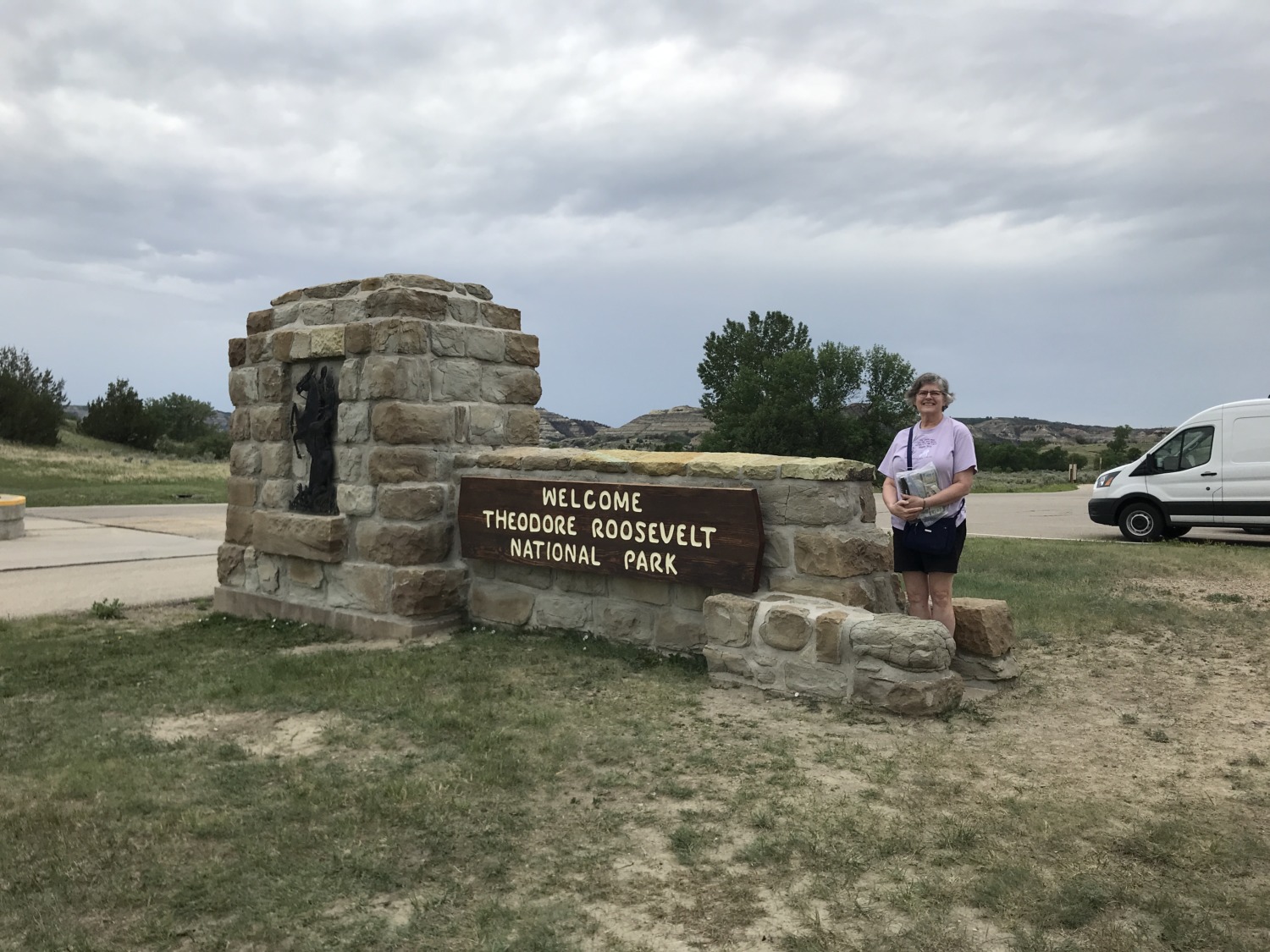
Theodore Roosevelt National Park is just a short distance south of where Tom and I are working for the summer. We have only been in North Dakota a month and already we have been to Theodore Roosevelt three times. I’m going to be writing a lot about the National Park this week, beginning with the North Unit.
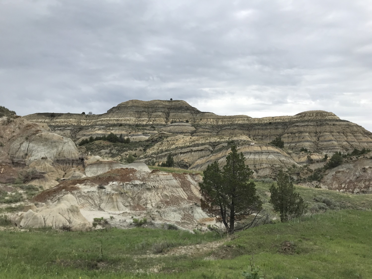
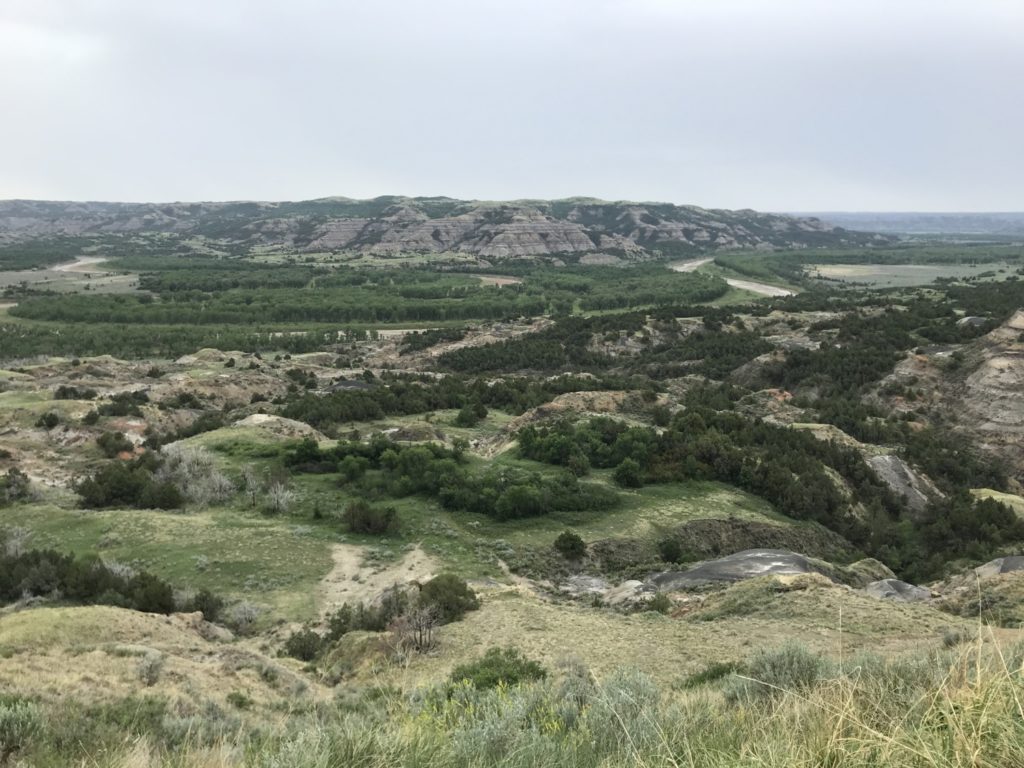
Most people don’t know that North Dakota has badlands that rival those in South Dakota. In fact, the western part of the state looks a lot like Badlands National Park, except it is greener and has more wildlife. Fortunately, a good portion of this land is protected by either Theodore Roosevelt National Park or the Little Missouri National Grasslands managed by the Bureau of Land Management. The North Unit of Theodore Roosevelt National Park straddles the most rugged badlands terrain.
The Little Missouri River, through centuries of ebb and flow, flood and drought, has cut a deep swath into the soft clay sand. Wind and water erosion reveals fantastic colors and shapes carved into the buttes. The entire area was once a cypress swamp of immense size, inhabited by dinosaurs. Today fossils, petrified wood, and oil deposits can be found all over the North Dakota badlands.
The North Unit, surrounding the meandering course of the Little Missouri River, is 50 miles north of I-94 and the South Unit. Because it is off the beaten path, it has about ¼ the visitors of the South Unit. Most people are content to say they have “done” Theodore Roosevelt if they have driven around the South Unit Loop. But, because we are so close, Tom and I expect to explore the park in a lot more detail. Not to mention that the North and South unit have separate NPS Passport stamps!
Because Theodore Roosevelt is a National Park (as opposed to a National Park site), there is a pretty stiff admission fee. Each vehicle is charged $30 per day. Usually Tom and I show our Volunteer Passes and get into parks free, but our passes from 2020 expired, and we haven’t volunteered the 250 hours necessary to get one for 2021 (yet). So Tom finally broke down and agreed he needed to get a National Park Senior Pass. You are eligible to purchase one when you turn 62. Although the pass costs $80, it is good for the rest of his life and covers anyone else in our vehicle. We expect the pass to pay for itself just in our visits to Theodore Roosevelt National Park this summer.
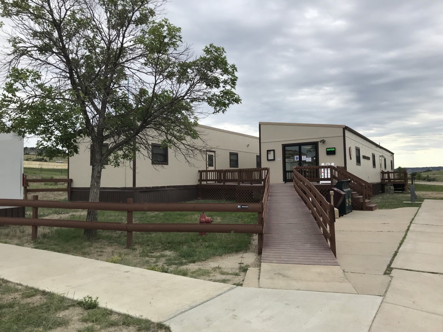
The entrance to the North Unit is just off US 85. There used to be a lovely stone Visitors Center, but eroding land caused the walls and foundation to crack in 2013. Although the NPS has identified a replacement location, it might be years before a new Visitors Center can be built. In the meantime, two trailers serve as a tiny Visitors Center and office space. It was large enough for me to get my stamp and talk to the Ranger for a few minutes, but we did not linger.
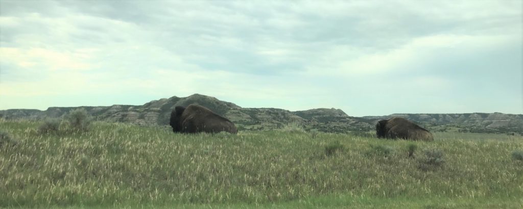
The North Unit has a 14 mile scenic drive. Tom and I took it on a day where it rained off and on so we didn’t do any hiking. It would be dry while we were driving to a trailhead, and then start raining as soon as we got out of the car. Consequently we had a lovely, non-strenuous drive where we enjoyed the overlooks. We decided it was a scouting mission and we intend to go back and try out some of the trails. A couple of bison were lying down right beside the road so we were able to get some up close and personal pictures without getting out of the car.
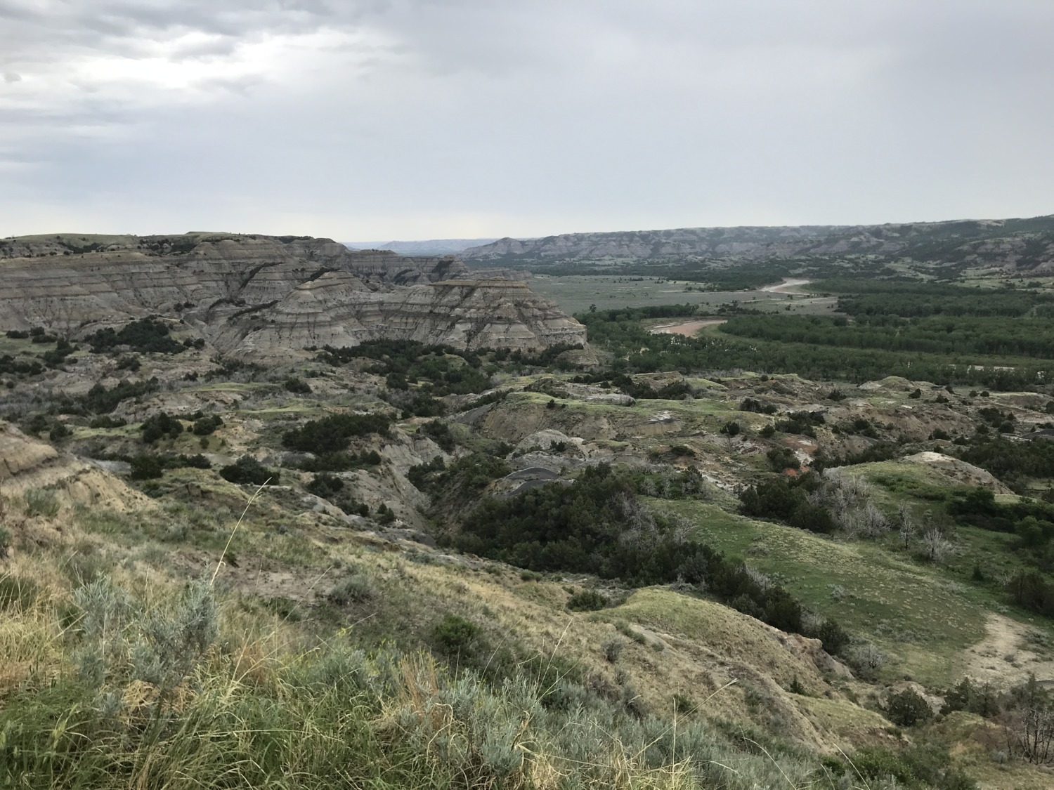
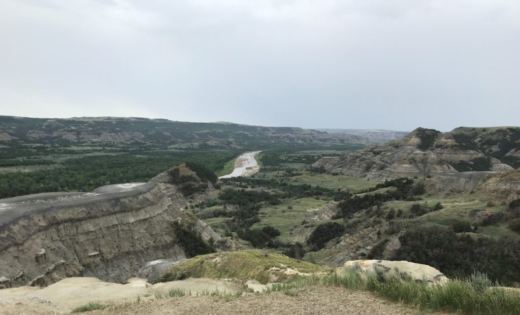
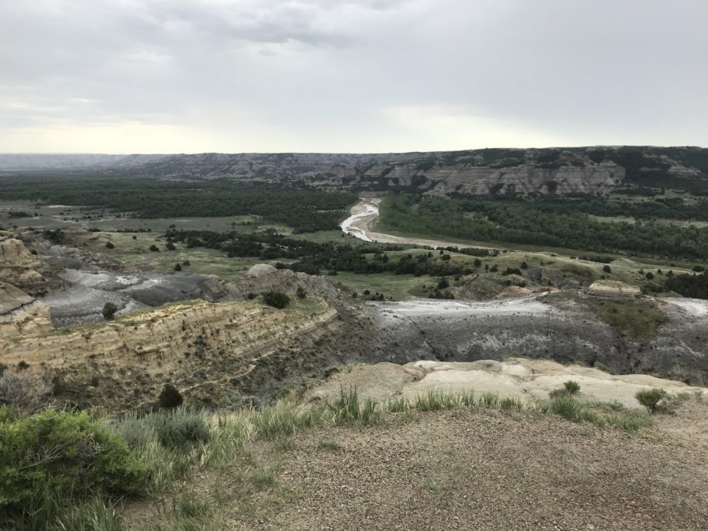
The Little Missouri River wove in and out of our view along the drive, and the scenic overlooks revealed it far below. Because of the drought in western North Dakota, the river is almost dry in spots. It is never very deep, but usually it is a wide swath of muddy water meandering back and forth across the valley. Theodore Roosevelt fell in love with the badlands carved by the Little Missouri River and came to the area to grieve and recover after his wife and mother both died on the same day.
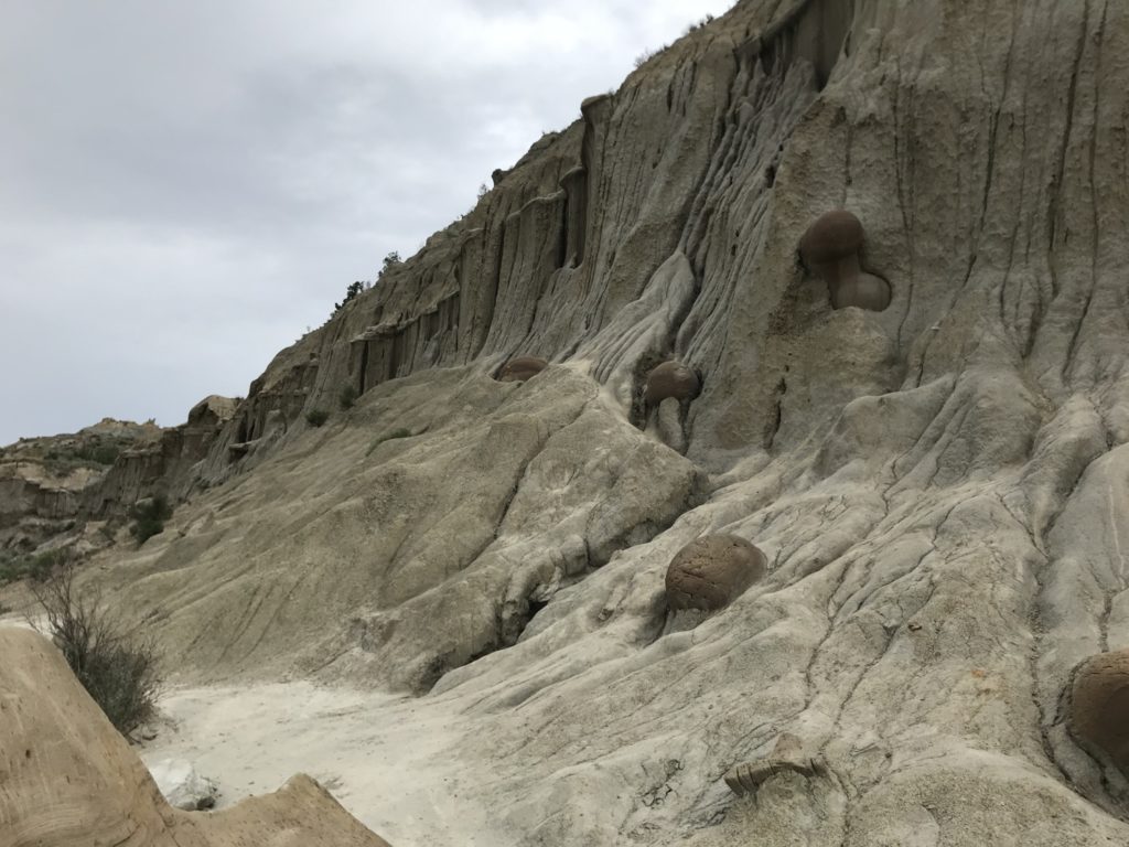
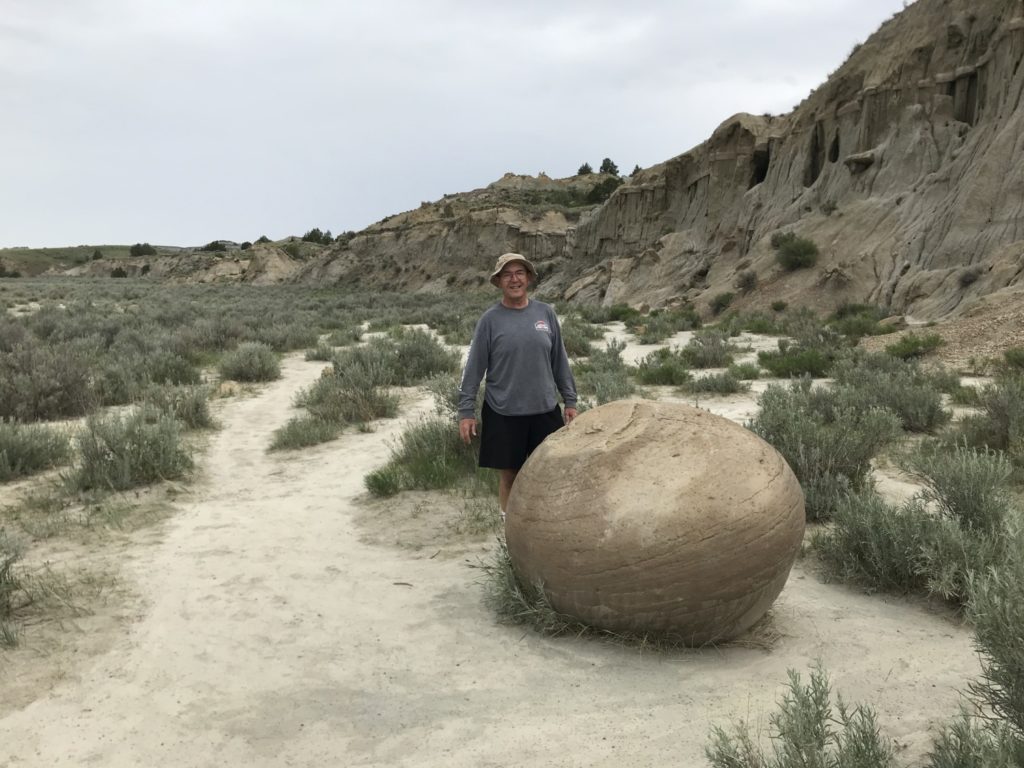
There are two notable stops along the scenic drive in the North Unit. The first was the Cannonball Concretions Pullout, referring to the rock formations that look like cannonballs. The cannonballs were formed when sand grains from an ancient river deposit were cemented together by minerals dissolved in groundwater. It looks as if these solid balls of stone were fired into the eroding, sandy walls of the buttes.
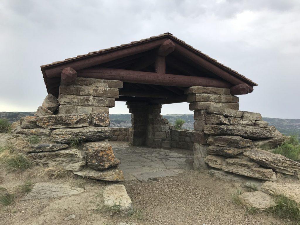
The most spectacular overlook along the drive is the River Bend Overlook. A short walk from the parking lot took us to a stone shelter built in the 1930’s by the Civilian Conservation Corps. We were thankful for its shelter as it (of course) started to rain as soon as we got out of the car.
Although the weather did not cooperate, Tom and I enjoyed the scenic drive in the North Unit very much. We plan to return on a drier day and do some hiking on the many trails winding in and out of the badlands.