
In History Lesson 6 I talked about Braddock Road Trace and Washington’s Trace, the preliminary roads across part of Pennsylvania. Today I am taking that lesson to the next level with the building of the first national road in the United States.
After the French and Indian War, Great Britain agreed that settlers would not cross the Allegheny and Appalachian mountains. This was part of the Treaty of Paris of 1763 and was a way to get the Native Americans to keep the peace. Almost immediately, however, settlers started heading further west, into and beyond the mountains. Although the British government refused to protect them, they also didn’t do anything to remove them.
By the time of the Revolutionary War there were already more than 100,000 settlers west of the Allegheny and Appalachian mountains. Eventually the United States government gave up keeping treaties with the Native Americans and started selling land to settlers west of the mountains. The United States government realized a road was needed to connect the populated east coast with the people in the west. There needed to be a good way to get raw materials from the west and manufactured goods to the west.
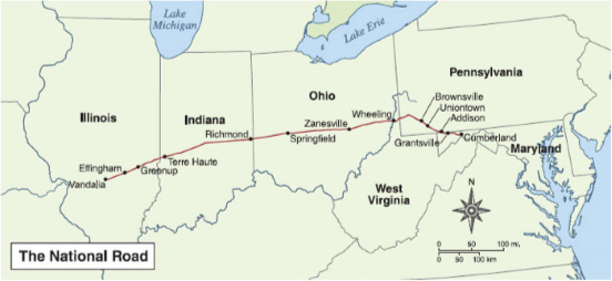 After years of discussions, Congress finally decided to build a National Road. After more discussion, they decided the road would go the shortest route from the east coast to the Ohio River. Because there was already a very good road from Baltimore, Maryland to Cumberland, Maryland, Congress felt the shortest, and thus cheapest road could be built from Cumberland to Wheeling, (now West) Virginia. The road would be paid for to Ohio by selling land in Ohio. Then the road would be paid for through Ohio by selling land in Indiana. Finally, the road would be paid for through Indiana and Illinois by selling land in Illinois and Missouri.
The first National Road was authorized in Congress in 1806. They got permission from the states and appropriated money for the building to begin in 1811. By 1818 the road was completed to Wheeling. It was completed all the way to Vandalia, Illinois by 1838. This was a good road that connected the country all the way from Baltimore to Vandalia. Over 90,000 people would travel along the National Road each year during the 1830’s and 1840’s. Markers, first of stone and then of cast iron, were placed every five miles along the road to mark the distance from Cumberland.
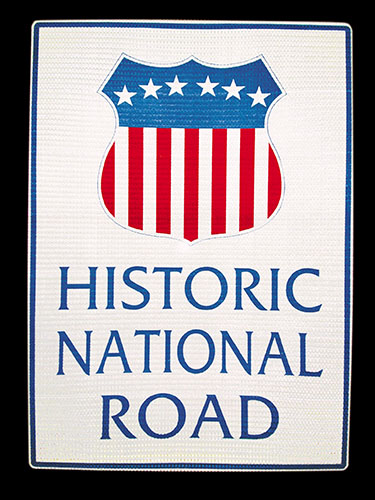 Today the National Road is usually known as US 40 between Baltimore and St. Louis, Missouri. In most places, it parallels Interstate 70. But you can still see signs and the history of the National Road if you get off the Interstate. Next week I will talk about some of those historic sights that you can still see in Pennsylvania.
Ok….. so maybe I should’ve caught up on the blog BEFORE we came to visit!
Easier to remember it when you see it firsthand.